


Click Image to Enlarge
Colorado Counties
Colorado currently has sixty-four counties. In February 1866, the first new county, Las Animas, was created. Alamosa was created in 1913, and in 2001, Broomfield was recognized as a city-county, bringing a total of 64 counties.Costilla County, Colorado
Costilla County Education, Geography, and History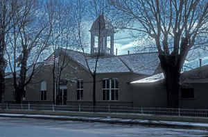
Costilla County is the ninth-least populous of the 64 counties in the state of Colorado. Based on the 2010 census, the population was 3,524. The county seat is San Luis, the oldest town in Colorado. Costilla County was created on November 1, 1861 as one of the 17 original counties of the Territory of Colorado. The county is named after the Costilla River. Costilla is a Spanish word meaning either little rib or furring timber.
Etymology - Origin of Costilla County Name
Costilla County is named for the Costilla River.
Demographics:
County QuickFacts: CensusBureau Quick Facts
Costilla County History
Costilla County was the first area of Colorado to be settled by European-Americans. Hispanic settlers
from Taos, New Mexico, officially established San Luis on April
9,1851. Costilla County was one of the
original 17 counties created by the Territory of Colorado on
November 1,1861. The county is named for the
Costilla River. San Miguel was originally designated the county seat, the county government was
moved to San Luis in 1863.
Originally boundaries had the county extend over much of south-central Colorado. Much of the
northern portion became part of Saguache County in 1866. The western
parts were included into
Hinsdale and Rio Grande counties in 1874. Costilla County
reached its modern boundaries in 1913 when
Alamosa County was created from its northwest portions.
Geography: Land and Water
As reported by the Census Bureau, the county has a total area of 1,230 square miles (3,187 km2), of which, 1,227 square miles (3,178 km2) of it is land and 3 square miles (9 km2) of it (0.27%) is water.
Costilla county is located in south-central Colorado in the San
Luis Valley and is bordered on the south by New Mexico, on the west
by the Rio Grande (separating it from Conejos County), and by
Alamosa county in the NW. The eastern border goes to the top of the
Sangre de Cristo Range.
Neighboring Counties
Bordering counties are as follows:
- Northeast: Huerfano County
- East: Las Animas County
- Southeast: Colfax County, N.M.
- South: Taos County, N.M.
- West: Conejos County
- Northwest: Alamosa County
Education


Click Image to Enlarge
