


Click Image to Enlarge
Colorado Counties
Colorado currently has sixty-four counties. In February 1866, the first new county, Las Animas, was created. Alamosa was created in 1913, and in 2001, Broomfield was recognized as a city-county, bringing a total of 64 counties.Jackson County, Colorado
Jackson County Education, Geography, and History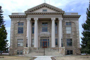
Jackson County is the fourth-least densely populated of the 64 counties of the state of Colorado. Based on the 2010 census, the population was 1,394, making it the fourth-least populated county in Colorado. The county seat and only incorporated municipality in the county is Walden. Jackson County was created on May 5, 1909 from Larimer County. The county is named in honor of Andrew Jackson (1767 - 1845), the seventh President of the United States.
Etymology - Origin of Jackson County Name
Jackson County is named in honor of Andrew Jackson, the seventh President of the United States.
Demographics:
County QuickFacts: CensusBureau Quick Facts
Jackson County History
Jackson County was formed out of Larimer
county on May 5, 1909. Before 1909, no one paid much attention to North Park because it was the hunting grounds of the Ute and
Arapaho Indians. They fiercely defended these lands and the white settlers were often afraid to venture in. When
valuable minerals were discovered in North Park, Grand County claimed it as part of their county because they wanted the
revenue it would provide. The residents didn't care much because the county seat for Grand County was closer than the
one in Larimer County, and all official business needed to be done at the county seat. But Larimer also claimed this
county and it was contested all the way to the Colorado Supreme Court. In 1886 the court decided in favor of Larimer.
This did not make the North Park residents very happy and they pushed for their own county until Jackson was formed.
Geography: Land and Water
As reported by the Census Bureau, the county has a total area of 1,621 square miles (4,198 km2),
of which, 1,613 square miles (4,178 km2) of it is land and 8 square miles (20 km2) of it (0.48%) is
water
Most of Jackson County is a high relatively broad basin known as North Park which covers 1613 square miles. This basin opens north into Wyoming and is rimmed on the west by the Park Range, on the south by the Rabbit Ears Range, and on the east by the Medicine Bow Mountains. Elevations ranges from 7,800 to 12,953 feet above sea level and is home to the head waters of the North Platte River.
Neighboring Counties
Bordering counties are as follows:
- Northeast: Albany County, Wyo.
- East: Larimer County
- Southeast: Grand County
- Southwest: Routt County
- Northwest: Carbon County, Wyo.
Education


Click Image to Enlarge
