


Click Image to Enlarge
Colorado Counties
Colorado currently has sixty-four counties. In February 1866, the first new county, Las Animas, was created. Alamosa was created in 1913, and in 2001, Broomfield was recognized as a city-county, bringing a total of 64 counties.Jefferson County, Colorado
Jefferson County Education, Geography, and History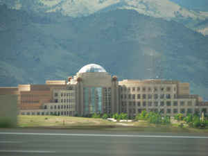
Jefferson County is one of the 64 counties in the state of Colorado. Based on the 2010 census, the
population was 534,543, making it the
fourth-most populous county in Colorado. The county
seat is Golden, and the most populous city is Lakewood.
Jefferson County was created on November 1, 1861
as one of the 17 original counties of the Territory of Colorado . The
county was named in honor of Thomas Jefferson (1743 -
1826), the author of the Declaration of Independence and the third
President of the United States.
Jefferson County is included in the Denver-Aurora-Lakewood, CO Metropolitan Statistical Area. Located along the Front Range of the Rocky
Mountains, Jefferson County is adjacent to the state capital of Denver.
Etymology - Origin ofJefferson County Name
Jefferson County is named for its predecessor county, Jefferson County, Jefferson Territory, which in turn was named in honor of Thomas Jefferson, the author of the Declaration of Independence and the third President of the United States.
Demographics:
County QuickFacts: CensusBureau Quick Facts
Jefferson County History
Arapahoe County, on August 25, 1855, was created by the Kansas Territorial Legislature to govern the entire western portion of the Territory of Kansas. The county was named for the Arapaho Nation of Native Americans that lived in the region.
The Jefferson Territory did not receive federal sanction, but on February 28,1861, US President James Buchanan signed an act organizing the Territory of Colorado. On November 1, 1861, the Colorado General Assembly organized the 17 original counties of Colorado including a new Jefferson County. In 1908, the southern tip of Jefferson County was transferred to Park County, decreasing Jefferson County to its present length of 54 miles (87 kilometers). Several annexations by the City and County of Denver and the 2001 consolidation of the City and County of Broomfield removed eastern portions of the county.
Geography: Land and Water
Jefferson County spans 4 to 18 miles (6 to 30 kilometers) west to east and 54 miles (87 kilometers) north to south. As reported by the Census Bureau, the county has a total area of 778 square miles (2,015 km2), of which, 772 square miles (2,000 km2) of it is land and 6 square miles (15 km2) of it (0.77%) is water.
Jefferson County is where the great plains meet the Rocky Mountains.
The county is made up of rolling grasslands and rugged rock formations,
natural foothills, jagged mountains and mountain streams.
Neighboring Counties
Bordering counties are as follows:
- North: Boulder County
- Northeast: Denver city & county; Adams County
- East: Arapahoe County
- Southeast: Douglas County
- South: Teller County
- Southwest: Park County
- Northwest: Clear Creek County; Gilpin County
Education


Click Image to Enlarge
