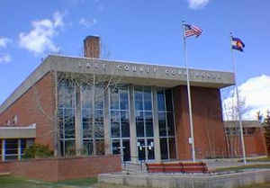
Lake County, Colorado
Lake County Education, Geography, and History
Lake County is one of the 64 counties of the State of Colorado of the United States. The highest point in Colorado and the entire Rocky Mountains is the summit of Mount Elbert in Lake County at 4401 meters (14,440 feet) elevation. The county population was 7,812 at US Census 2000. The county seat is Leadville. Lake County was created on November 1, 1861 as one of the 17 original counties of the Territory of Colorado. The county is named for the Twin Lakes in the county.
The Edwards Micropolitan Statistical Area comprises Eagle County and Lake County.
Etymology - Origin of Lake County Name
Lake County is named for the Twin Lakes in the area.
Demographics:
County QuickFacts: CensusBureau Quick Facts
Lake County History
Lake County was one of the original 17 counties created by the Colorado legislature on November 1, 1861. As originally defined, Lake County included a large portion of western Colorado to the south and west of its present boundaries.
The county is named for the
Twin Lakes in the area.
Lake County gradually lost territory over the following decades, losing land in its southeast to Saguache County in 1866 and Hinsdale County in 1874; in its southwest to La Plata County in 1874 and San Juan County in 1876, and in its west to Ouray and Gunnison counties in 1877.
Lake County's designated county seat changed multiple times within just a few years, residing successively in Oro City (from 1861), Lourette (from 1863), Dayton (from 1866), and Granite (from 1868).
By 1878, Lake County had been decreased to an area including only present-day Lake and Chaffee counties. On February 8, 1879, the Colorado legislature renamed Lake County Carbonate County, although this designation name only lasted for two days, until Chaffee County was split off from Carbonate's
southern section on February 10 and the remaining northern portion was designated Lake County with its current county seat of Leadville.
Geography: Land and Water
As reported by the Census Bureau, the county has a total area of 384 square miles (994 km2), of which, 377 square miles (976 km2) of it is land and 7 square miles (18 km2) of it (1.83%) is water.
Lake county is located close to the center of Colorado. Historic mountain towns settled among the highest peaks in Colorado,
surrounded by high alpine forests, pristine streams and glacial lakes.
Neighboring Counties
Bordering counties are as follows:
- Northeast: Summit County
- East: Park County
- Southeast: Chaffee County
- West: Pitkin County
- Northwest: Eagle County
Education


