


Click Image to Enlarge
Iowa Counties
There are ninety-nine counties in Iowa. The first two counties, Des Moines County and Dubuque County, were created in 1834 when Iowa was still part of the Michigan Territory. In preparation for Michigan's statehood, part of Michigan Territory was formed into Wisconsin Territory in 1836]. Two years later, the western portion was split off to become Iowa Territory. The south-eastern part of Iowa Territory became Iowa, the 29th state in the union, on 28 December 1846, by which point 44 Counties had been created. Counties continued to be created by the state government until 1857, when the last county, Humboldt County, was created.Cedar County, Iowa
Cedar County Education, Geography, and History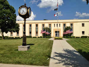
Cedar County is a county located in the state of Iowa. Based on the 2010 census, the
population was 18,499. Cedar County was created
on December 21, 1837. The county seat is Tipton.
The county is named for the Cedar River, which runs through the county.
Cedar County is located between the Cedar Rapids, Quad Cities and Iowa City metropolitan areas, areas also known as the "Tri-Metro" county. It
is the only Iowa county which shares the name of a tree.
Cedar County was the focus of the Iowa Cow War of 1931.
Etymology - Origin of Cedar County Name
Cedar county is named for the Cedar River.
Demographics:
County QuickFacts: CensusBureau Quick Facts
Cedar County History
Cedar County, one of the original
counties taken from Dubuque County, is named after the Red Cedar River that runs
through it.
When the county was established in 1837 the Territorial Legislature designated
the town of Rochester as the county seat. It was chosen because of its proximity
to stone and timber and it was the only area past Muscatine County that had
established ferry service. It was also the only place in the county that had a
name and people living in it.
The wheels of government in Cedar County first started turning April 12, 1838,
in Rochester. This was the only site on the river above Muscatine County where
regular ferry service had been established. At this time there were not more
than 150 residents in the county.
Soon population increased and along with it the county seat battle. Several
towns were in the running for the county seat; Centerville, Warsaw, Elizabeth,
Antwerp, Rochester and Tipton were all visited by the county seat locating
committee. After several weeks the committee chose Tipton. It is said that after
the site was chosen many whiskey bottles were broken open.
On December 11, 1839, a bill passed both houses in the legislature to change the
seat of justice for the county. The first county building in Tipton was a hewed
log cabin that served as a courthouse and jail. In the summer of 1841 the county
commissioners entered into a contract for the erection of a courthouse in the
public square. Work did not progress very well, until a change of contractors
took place. Commissioners accepted the courthouse from the new contractors in
May 1846.
In 1858 the county began the construction of a "more suitable temple of
justice." The cut stone and red brick building was completed in the summer of
1859 at a cost of $45,000. The courthouse was topped by a cupola, which was
later removed and replaced by a tower. In 1890 a $12,000 addition was completed.
This addition housed fireproof vaults. In 1901 the county and city purchased a
$985 clock for the tower. It was removed in 1949 because it was considered a
nuisance and unsafe.
On November 3, 1964 voters approved a $595,000 bond issue to replace the
courthouse. An additional $40,000 was approved for the building and equipping of
the courthouse in 1966. The courthouse, which sits in the center of the square,
was dedicated in the summer of 1968.
The Herbert Hoover National Historic Site was established at West Branch (in
Cedar County) on August 12, 1965 to create an area where people could come to
honor President Hoover and learn about the environment that helped to shape him.
The site includes the birthplace cottage, blacksmith shop, Quaker meeting house,
Herbert Hoover Presidential Library, and the graves of President and Mrs.
Hoover.
In addition, the National Park Service has acquired the first schoolhouse in
West Branch and several early homes. They've restored the exteriors to their
19th Century appearance.
Source: Beverly Fitch, Cedar County Recorder
Geography: Land and Water
As reported by the Census Bureau, the county has a total area of 582 square miles (1,510 km2), of which 579 square miles (1,500 km2) is land and 2.5 square miles (6.5 km2) (0.4%) is water.
Cedar county is located in east Iowa. Rock Creek flows through Cedar County.
Neighboring Counties
Bordering counties are as follows:
- North: Jones County
- Northeast: Clinton County
- Southeast: Scott County
- South: Muscatine County
- Southwest: Johnson County
- Northwest: Linn County
Education


Click Image to Enlarge
