


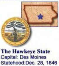
Iowa State Almanac: Facts and Figures
Quick Facts, Figures, and Overview of the State of Iowa
Iowa is one of the West North Central states of the US. Iowa is the 29th state of the United States. It is frequently called as the "American Heartland". The capital and biggest city of IA is Des Moines and the state covers a total land area of 56,272 sq. miles. It has common boundaries with Wisconsin, Minnesota, Missouri, Illinois, South Dakota, and Nebraska. Iowa's Name Origin was taken from 'The Iowa River' witch was named after the Iowa Indians who lived in the territory. The tribal name "Ayuxwa" was spelled by the French as "Ayoua" and by the English as "Ioway." "Ayuxwa" means "one who puts to sleep."
Although Iowa produces a tenth of the nation's food supply, the value of Iowa's manufactured products is twice that of its agriculture. Major industries are food and associated products, non-electrical machinery, electrical equipment, printing and publishing, and fabricated products.
Iowa stands in a class by itself as an agricultural state. Its farms sell over $10 billion worth of crops and livestock annually. Iowa leads the nation
in all corn, soybean, and hog marketing, and comes in third in total livestock sales. Iowa's forests produce hardwood lumber, particularly walnut,
and its mineral products include cement, limestone, sand, gravel, gypsum, and coal.
Iowa Almanac: Fast Facts and Figures on the State of Iowa |
|
|---|---|
| Official Name | Iowa |
| Capital | Des Moines |
| Nicknames | Hawkeye State ... and more |
| Motto | Our liberties we prize and our rights we will maintain |
| Location Region |
41.57673 N, 093.61740 W Midwest Northwestern |
| Constitution Ratified | 1857 |
| Statehood | December 28, 1846 29th state |
| Population | 3,046,355 (2010) 52.37 30th |
| Largest City (by population) |
10 largest cities (2010): Des Moines, 203,433; Cedar Rapids, 126,326; Davenport, 99,685; Sioux City, 82,684; Waterloo, 68,406; Iowa City, 67,862; Council Bluffs, 62,230; Ames, 58,965; Dubuque, 57,637; West Des Moines, 56,609. |
| Bordering States | North: Minnesota East: Wisconsin and Illinois (Mississippi River forms the entire Eastern border) South: Missouri West: Nebraska and South Dakota (Missouri River forms much of the Western border) |
| Major Industry | agriculture (corn, soybeans, hogs, pigs), food manufacturing, insurance |
| Major Rivers | Mississippi River, Des Moines River, Missouri River, Cedar River, Iowa River |
| Major Lakes | Lake Red Rock |
| Iowa Counties | 99 Counties in Iowa |
| Largest County (by population) |
Polk County 430,640 (2010) 570 sq. mi. |
| Largest County (by area) |
Kossuth County 973 sq. mi. |
| State forests | 10 (43,917 ac.) |
| State parks /recreation areas | 84 (53,000 ac.) |
| Presidential Birthplace | Herbert Clark Hoover was born in West Branch on August 10, 1874 (he was the 31st US President, serving from 1929 to 1933). |
| Electoral Votes | 7 |
| US Congress | 2 Senators; 5 Representatives |
| Time Zone | Central Standard Time |
| Zip Codes | NANPA |
| State Quick Facts | Census Bureau Quick Facts |
Iowa Climate and Weather |
|
|---|---|
| The weather in Iowa varies greatly from season
to season, with cold winters and hot summers. Each year the temperature drops to -20 F/-28 C and rises to 100 F/38 C somewhere in the state.
Although travel is generally pleasant from late spring to early fall, we recommend visiting from late August through October to enjoy comfortable
temperatures and humidity. Spring can be unsettled and stormy, though temperatures are comfortable. July can afflict Iowa with high temperatures and high humidifies, and that's the month that sees the greatest number of visitors. |
|
| Highest Temperature | 118 degrees July 20, 1934 - Keokuk |
| Lowest Temperature | 47 degrees January 12, 1912 - Washta |
| Avg. Temp: High - Low |
86.2 degrees 6.3 degrees |
Iowa Points of Interest |
|
| Tourist attractions include the Amana Colonies, Crystal Lake Cave, State Capitol, Fort Dodge Historical Museum, Fort, and Stockade; the Iowa State Fair at Des Moines in August; Herbert Hoover birthplace and library near West Branch; and the points-of-interest along both the Mormon Trail and the historic Lewis and Clark Trail to name but a few. | |
Iowa Highest, Lowest, and Mean Elevations (Feet) |
|
| Mean Elevation: 1,100 feet | |
| Highest Point: Hawkeye Point: Sec. 29, T100N, R41W, Osceola County: 1,670 feet
|
|
| Lowest Point: | Mississippi River 480 feet |
Iowa Land Area (Square Miles) |
|
| Geographic Center | Located in Story County, 5 miles NE of Ames. Longitude: 93°23.1'W Latitude: 41°57.7'N |
| Total Area | 56,271.55 sq. mi. 26th |
| Land Area | 55,869.36 sq. mi. 99.29% |
| Water Area | 402.2 sq. mi. 0.71% |
| Forested Land Area | 5.7% |
| Dimensions (Length - Width) |
310 miles - 200 miles |
 Just
southeast of the town of Ocheyedan, the Mound rises an impressive 170 feet above the surrounding flood plain. It is one of the highest points in
Iowa--1670 feet above sea level. The material making up the Mound is chiefly sand and gravel with small boulders of various types, including rocks
of many different kinds. There are granites, Sioux quartzite and limestone.
Just
southeast of the town of Ocheyedan, the Mound rises an impressive 170 feet above the surrounding flood plain. It is one of the highest points in
Iowa--1670 feet above sea level. The material making up the Mound is chiefly sand and gravel with small boulders of various types, including rocks
of many different kinds. There are granites, Sioux quartzite and limestone.Adair, Adams, Allamakee, Appanoose, Audubon, Benton, Black Hawk, Boone, Bremer, Buchanan, Buena Vista, Butler, Calhoun, Carroll, Cass, Cedar, Cerro Gordo, Cherokee, Chickasaw, Clarke, Clay, Clayton, Clinton, Crawford, Dallas, Davis, Decatur, Delaware, Des Moines, Dickinson, Dubuque, Emmet, Fayette, Floyd, Franklin, Fremont, Greene, Grundy, Guthrie, Hamilton, Hancock, Hardin, Harrison, Henry, Howard, Humboldt, Ida, Iowa, Jackson, Jasper, Jefferson, Johnson, Jones, Keokuk, Kossuth, Lee, Linn, Louisa, Lucas, Lyon, Madison, Mahaska, Marion, Marshall, Mills, Mitchell, Monona, Monroe, Montgomery, Muscatine, O'Brien, Osceola, Page, Palo Alto, Plymouth, Pocahontas, Polk, Pottawattamie, Poweshiek, Ringgold, Sac, Scott, Shelby, Sioux, Story, Tama, Taylor, Union, Van Buren, Wapello, Warren, Washington, Wayne, Webster, Winnebago, Winneshiek, Woodbury, Worth, Wright

