


Click Image to Enlarge
Iowa Counties
There are ninety-nine counties in Iowa. The first two counties, Des Moines County and Dubuque County, were created in 1834 when Iowa was still part of the Michigan Territory. In preparation for Michigan's statehood, part of Michigan Territory was formed into Wisconsin Territory in 1836]. Two years later, the western portion was split off to become Iowa Territory. The south-eastern part of Iowa Territory became Iowa, the 29th state in the union, on 28 December 1846, by which point 44 Counties had been created. Counties continued to be created by the state government until 1857, when the last county, Humboldt County, was created.Dickinson County, Iowa
Dickinson County Education, Geography, and History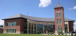
Dickinson County is a county located in the state of Iowa. Based on the 2010 census, the
population was 16,667. The county was created in 1857. The
county seat is Spirit Lake.
Dickinson county is named in honor of Daniel S. Dickinson, a US Senator for New York.
Dickinson County comprises the Spirit Lake, IA Micropolitan Statistical Area
Etymology - Origin of Dickinson County Name
Dickinson is named for Daniel Stevens Dickinson, a United States senator from New York.
Demographics:
County QuickFacts: CensusBureau Quick Facts
Dickinson County History
Dickinson County, the smallest county
in land area, is named in honor of Daniel S. Dickinson, a lawyer and senator
from New York.
The county was established in 1851. In the summer of 1856 Rowland Gardner came
from Cerro Gordo County to settle. He and his family erected cabins, which came
to be known as Gardner's Grove. Soon after many families started to settle in
the area. But by the end of the year the population was only 40 residents, half
of that being children.
In the winter of 1856-1857 a renegade band of Sioux Indians attacked the
settlers around the lake, killing all but four women. Later, two of the four
women were murdered and the remaining two were rescued. For six days the
ravaging and pillaging of settlements and killing of livestock continued. Word
of the "Spirit Lake Massacre" finally reached Fort Dodge. An expedition was
launched to pursue the Indians, but the main job turned out to be burying the
dead.
Following the massacre there was a large increase in settlers, especially in the
summer. This second wave of pioneers organized the county for independence. A
petition was sent to the judge in Woodbury County, a seven-day journey by
horseback, asking for a separate organization. An election was held calling for
county officials, and on August 4, 1857 Dickinson County was formed and in 1858
the county originated.
The first courthouse was built in Spirit Lake. It was begun in 1859 and
partially finished in 1860. In 1860 it was used as a barracks for Civil War
troops and was completed in 1868. This building was destroyed by fire in 1872.
A second courthouse was constructed using the salvageable bricks of the first
courthouse, but it was soon deemed unsatisfactory and condemned in 1880.
In September 1889 a $15,000 bond issue was proposed for the construction of a
new courthouse. It was passed by a large majority. Construction of the third
courthouse began on October 4, 1890 and was completed in 1891. Since its
completion the building has seen three additions, one in 1957 and two more in
1976 and 1978. The funding for these additions came from the Federal Revenue
Sharing fund.
Source: Early History of Dickinson County
Geography: Land and Water
As reported by the Census Bureau, the county has a total area of 404 square miles (1,050 km2), of which 381 square miles (990 km2) is land and 23 square miles (60 km2) (5.8%) is water.
Dickinson county is located in northwest Iowa. The county is the smallest county by land area in Iowa, and the fifth-smallest by total area.
A region known as the Iowa Great Lakes is in Dickinson County, making it a popular vacation destination for Iowans, and explaining the recent
high population growth in the area. The lakes include West Okoboji Lake, East Okoboji Lake, and Spirit Lake.
Neighboring Counties
Bordering counties are as follows:
- North: Jackson County, Minn.
- East: Emmet County
- Southeast: Palo Alto County
- South: Clay County
- Southwest: O'Brien County
- West: Osceola County
Education


Click Image to Enlarge
