


Click Image to Enlarge
Nebraska Counties
There is ninety-three counties in state of Nebraska. Despite the fact that Sarpy County contained the oldest settlement in the state, it was one of the last lands along the river to be recognized by law. Finally, on February 1, 1857, the land "where the cities meet the country" was officially created.Banner County, Nebraska
Banner County Education, Geography, and History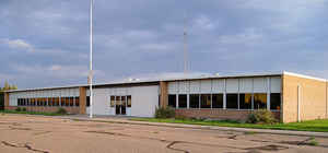
Banner County is a county located in the state of Nebraska. Based on the 2010 census, the population was 690. Its county seat is Harrisburg;
there are no incorporated municipalities within the county.
Banner County is part of the Scottsbluff, NE Micropolitan Statistical Area.
Etymology - Origin of Banner County Name
According to some, early settlers in this Panhandle region aspired to make it the "banner county" of the state since it was to be "the brightest star in the constellation of Nebraska counties."
Demographics:
County QuickFacts: CensusBureau Quick Facts
Banner County History
Banner County is one of two counties in Nebraska that received its name from the aspirations of the inhabitants. According to some, early settlers
in this Panhandle region aspired to make it the "banner county" of the state since it was to be "the brightest star in the constellation of Nebraska
counties."
The area that today makes up Banner County was once part of a larger Cheyenne County. In an election held on Nov. 6, 1888, Banner, Kimball and Scotts
Bluff Counties were created from the western third of Cheyenne County. Immediately upon receiving word that the area would become a county, local residents
proposed a design for a county seal. In the center of a circle is a banner, and across the banner is a line representing Pumpkin Creek which traverses
the area from west to east. In the center of the banner is a pumpkin.
Banner County was officially organized on Jan. 29, 1889, and the settlement of Ashford was designated as a temporary county seat. A special election
was scheduled for the following month to select a permanent site from among four aspirants: Ashford; Banner; Freeport; and Harrisburg. It actually
took two elections, with Harrisburg finally being chosen.
Geography: Land and Water
Cattle grazing near buttes on north side of Pumpkin Creek valley
As reported by the Census Bureau, the county has a total area of 746 square miles (1,930 km2), of which 746 square miles (1,930 km2) is land and
0.2 square miles (0.52 km2) (0.02%) is water.
Banner County lies on what was once a tableland sloping away from the Rocky Mountains. Over geologic history, it was eroded by Pumpkin Creek and
other watercourses, and much of the county now lies below the original High Plains level. The county can be divided into four major geographic
divisions: the low-lying and relatively flat valley of Pumpkin Creek, which occupies about 40% of the county's area; a tableland, in places smooth
and in others deeply dissected, occupying the southern one-third of the county; the Wildcat Hills, a highly dissected escarpment that crosses the
northwestern portion of the county; and a small portion of the North Platte River valley in the northeastern corner of the county.
Neighboring Counties
Bordering counties are as follows:
- Scotts Bluff County, Nebraska - north
- Morrill County, Nebraska - east
- Cheyenne County, Nebraska - southeast
- Kimball County, Nebraska - south
- Laramie County, Wyoming - west
- Goshen County, Wyoming - northwest
Education
Banner County is covered by a single school district, with a K - 12 school located in Harrisburg. The school's enrollment is about 175.


Click Image to Enlarge
