


Click Image to Enlarge
Nebraska Counties
There is ninety-three counties in state of Nebraska. Despite the fact that Sarpy County contained the oldest settlement in the state, it was one of the last lands along the river to be recognized by law. Finally, on February 1, 1857, the land "where the cities meet the country" was officially created.Chase County, Nebraska
Chase County Education, Geography, and History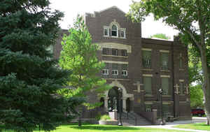
Chase County is a county located in the state of Nebraska. Based on the 2010 census, the population was 3,966. Its county seat is Imperial.
Etymology - Origin of Chase County Name
The county was named after Champion S. Chase, who served as mayor of Omaha for seven years and was Nebraska's first Attorney General.
Demographics:
County QuickFacts: CensusBureau Quick Facts
Chase County History
It was once said that excluding ranch
owners, their wives and their cooks, at the time Chase County was organized in
1886 it was populated entirely by cowboys. Part of the reason for such a
statement may have been the fact that at one time the Frenchman River, which
traverses the county, was used as a watering stop for cattle drives that
traveled from Texas to Ogallala.
But being situated on the broad, fertile plateau once referred to as the "Great
American Desert," early settlers quickly discovered Chase County's dark sandy
loam soil was excellent for farming. Today, records indicate that more than 30
percent of the county's 576,000 acres are irrigated. Another 25 percent are
involved in dryland crop operations. The remaining acres are range land. Wheat,
corn, beans and beets are today the principal crops, with livestock production
being of equal importance to the county's economy.
The organization of Chase County began in 1886, but it was not until Feb. 27,
1873 that the county boundaries were officially established by the Legislature.
Previous to that, Chase and Hayes County were one. The county was named after
Champion S. Chase, who served as mayor of Omaha for seven years and was
Nebraska's first Attorney General.
A Canadian emigrant, Thomas Mercier, settled on the site that would eventually
become the county seat. It is said that Mercier laid out the town and gave it
its name, presumably after the British Imperial government.
Several towns within the county competed to become the county seat. It took
three elections before any town received a majority of the votes. That town was
Imperial and in 1889 the first courthouse was built. For more than 20 years the
courthouse was the social center of the community. The building was home to
church services, school programs and social balls, in addition to housing the
local government offices. But in 1910 the building was destroyed by fire. The
following year a new brick and cement courthouse replaced it. That building is
still in use today.
Geography: Land and Water
As reported by the Census Bureau, the county has a total area of 897 square miles (2,320 km2), of which 894 square miles (2,320 km2) is
land and 3.1 square miles (8.0 km2) (0.3%) is water.
Chase County is geographically diverse. The spring-fed Frenchman Creek crosses the county from west to southeast. From Enders to Wauneta the
path of the creek exposes limestone outcroppings. North of Wauneta is an area of significant loess deposits, including the typical
steep-walled canyons. Rolling Sandhills formations are found in the north-central and southwestern areas of the county.
The Pierre Shale of Upper Cretaceous Age is the underlying structure of the region. At Enders Dam this formation is found at a depth of 175
feet (53 m) below the valley floor. The Ogallala Formation of Pliocene Age overlies the Pierre Shale. The Ogallala Formation is composed of
fine to course sand, some gravel, calcareous silt, silty sands, silts and clays. Various degrees of calcareous cementation occur, resulting in
lenses of varying loose unconsolidated to very firm compact materials at irregular intervals. The Ogallala beds lie almost horizontal and
structural irregularities, such as faulting, have been observed in the area.
The Ogallala Formation is of vital importance to the county and the surrounding areas. The associated Ogallala Aquifer is the primary source
of water for the population and livestock, and an important input into agricultural economy of the county.
Neighboring Counties
Bordering counties are as follows:
- Hayes County, Nebraska (east)
- Dundy County, Nebraska (south)
- Yuma County, Colorado (southwest)
- Phillips County, Colorado (west)
- Perkins County, Nebraska (north)
Education


Click Image to Enlarge
