


Click Image to Enlarge
Nebraska Counties
There is ninety-three counties in state of Nebraska. Despite the fact that Sarpy County contained the oldest settlement in the state, it was one of the last lands along the river to be recognized by law. Finally, on February 1, 1857, the land "where the cities meet the country" was officially created.Franklin County, Nebraska
Franklin County Education, Geography, and History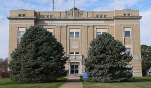
Franklin County is a county located in the state of Nebraska. Based on the 2010 census, the population was 3,225. Its county seat is Franklin. The county was formed in 1867 and later organized in 1871. It was named after Benjamin Franklin
Etymology - Origin of Franklin County Name
Named after American statesman and philosopher Benjamin Franklin
Demographics:
County QuickFacts: CensusBureau Quick Facts
Franklin County History
Advertisements appearing in Eastern
and European newspapers in the 1860s claimed the Republican River area, south of
Fort Kearny, offered an abundance of fuel, wild game, and a beauty that could
not be found elsewhere. Such advertisements led to an inpouring of early
settlers.
The advertisements did tell prospective settlers the truth, as they found easily
accessible creeks and springs and a vast amount of timberland that accommodated
many of their needs, particularly in the southern portion of what would become
Franklin County.
By an act of the Legislature, Franklin County was organized in March 1871. Named
after American statesman and philosopher Benjamin Franklin, the county's
boundaries were actually approved four years earlier. The first post office,
according to historical records, opened in 1873. The following year the United
States Land Office moved from Lowell to Bloomington and brought people in from a
10-county area. This move, combined with the fact that Bloomington was laid out
along the Chicago, Burlington and Quincy Railroad line, resulted in a tremendous
increase in business activity for the village.
A move of the county seat was next, as the inhabitants of the area voted to
relocate it from Franklin City to Bloomington. As Bloomington continued to grow,
Franklin City would soon cease to exist. At the same time, Riverton and Naponee
would incorporate on the east and west ends of the county, respectively.
With the demise of Franklin City came the founding of Franklin, located just to
the east of the former settlement in the south-central portion of the county.
Franklin was incorporated in July 1883. Within 10 years, Hildreth, Campbell and
Upland were incorporated.
Bloomington's boom was short-lived as in 1893 the US Land Office was
permanently closed. In the years that followed the population began to shift
away from Bloomington and toward Franklin. By 1920, voters in the county chose
to move the county seat from Bloomington to Franklin.
Geography: Land and Water
As reported by the Census Bureau, the county has a total area of 576 square miles (1,490 km2), of which 576 square miles (1,490 km2) is
land and 0.2 square miles (0.52 km2) (0.03%) is water. The Republican River flows through the southern part of Franklin County.
Neighboring Counties
Bordering counties are as follows:
- Kearney County - north
- Webster County - east
- Smith County, Kansas - southeast
- Phillips County, Kansas - southwest
- Harlan County - west
- Phelps County - northwest
Education


Click Image to Enlarge
