


Click Image to Enlarge
Nebraska Counties
There is ninety-three counties in state of Nebraska. Despite the fact that Sarpy County contained the oldest settlement in the state, it was one of the last lands along the river to be recognized by law. Finally, on February 1, 1857, the land "where the cities meet the country" was officially created.Keya Paha County, Nebraska
Keya Paha County Education, Geography, and History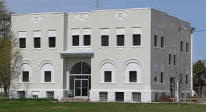
Keya Paha County is a county located in the state of Nebraska. Based on the 2010 census, the population was 824. Its county seat is Springview.
Etymology - Origin of Keya Paha County Name
One of the most unique names among Nebraska's 93 counties
belongs to Keya Paha County in the north central area of the state. It is traced
to the Dakota Sioux Indian tribe, which once hunted on the land north of the
Niobrara River.
According to historians, the county's name is derived from the Dakota words
K?ya Pa-h?Wa-kp? which translated means turtle hill river. It is assumed that
this was how the Dakotas referred to the area, because numerous small, rounded
hills make up the terrain.
Demographics:
County QuickFacts: CensusBureau Quick Facts
Keya Paha County History
Keya Paha County was once part of a
much larger county known as Brown. This area included what today are Brown, Rock
and Keya Paha Counties. In 1884 it became apparent that the existing Brown
County was too large and a petition was circulated to designate the area north
of the Niobrara River as a separate county. When the question was put before the
voters on Nov. 4, it carried by a wide margin.
Locating the county seat proved to be more difficult than creating the county.
Nearly every settlement within the new county sought this important distinction.
A committee was appointed to make a selection. But failing to accomplish this,
the issue was put to a vote when the county's first election was held in January
1885. Fifteen different settlements were listed on the ballot. The field was
pared to two and the newly-elected county officers ordered another election for
March 24.
When election day arrived, voters were asked to choose either Burton, located in
the northeast part of the county, or Springview, which was more centrally
located. When the votes were counted, Springview won by a narrow 494 to 405
margin.
Springview included 160 acres of choice land and a natural spring, for which the
settlement had been named. Lots in the county seat were sold for $20 each.
Building activity began almost immediately after the election. Until enough lots
were sold to accumulate the necessary funds to build a courthouse, county
offices were housed in a private residence.
Geography: Land and Water
As reported by the Census Bureau, the county has a total area of 774 square miles (2,000 km2), of which 773 square miles (2,000 km2) is
land and 0.8 square miles (2.1 km2) (0.1%) is water.
Keya Paha County is located in Nebraska's Outback region
Neighboring Counties
Bordering counties are as follows:
- Tripp County, South Dakota - north
- Gregory County, South Dakota - northeast
- Boyd County - east
- Holt County - southeast
- Rock County - south
- Brown County - south
- Cherry County - west
- Todd County, South Dakota - northwest
Education


Click Image to Enlarge
