


Click Image to Enlarge
Nebraska Counties
There is ninety-three counties in state of Nebraska. Despite the fact that Sarpy County contained the oldest settlement in the state, it was one of the last lands along the river to be recognized by law. Finally, on February 1, 1857, the land "where the cities meet the country" was officially created.Morrill County, Nebraska
Morrill County Education, Geography, and History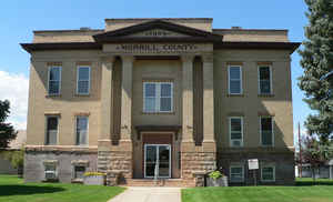
Morrill County is a county located in the state of Nebraska. Based on the 2010 census, the population was 5,042. Its county seat is Bridgeport
Etymology - Origin of Morrill County Name
The county was named after Charles H. Morrill, who was president of the Lincoln Land Company.
Demographics:
County QuickFacts: CensusBureau Quick Facts
Morrill County History
Morrill County is among the handful
of Nebraska counties that was organized after the turn of the 20th century. For
many years this area in the central Nebraska Panhandle was part of a larger
Cheyenne County. But in 1907 the first steps were taken to organize Morrill
County when the citizens along the northern boundary of Cheyenne County
petitioned the Board of Commissioners to approve a separation.
A special election was called for Nov. 3, 1908, and the proposal was approved by
the local electorate. Nine days later a proclamation officially creating Morrill
County was signed by Gov. George L. Sheldon. The county was named after Charles
H. Morrill, who was president of the Lincoln Land Company.
Morrill County is the home of many prominent Nebraska landmarks. Chimney Rock,
Courthouse Rock and Jail Rock, and the Mud Springs pony express, stage coach and
telegraph station were all welcome sights to the weary travelers who in the mid
1800s followed the Mormon Trail, Oregon Trail and Deadwood Trail. Today, these
landmarks are popular tourist attractions.
Like many other counties, the 1904 passage of Kinkaid Act attracted many new
settlers to the area. These settlers found the high table lands bordering the
North Platte River Valley ideal for raising grain. The excellent meadows in the
northern part of the county were excellent for cattle ranching.
In the years that immediately preceded the official organization of Morrill
County, the railroads began pushing through the area. The first line was built
by the Burlington Railroad in 1889 from Alliance to Guernsey, Wyo. In 1917 the
Union Pacific Railroad built its line from North Platte to Gering, dissecting
the entire county. Both rail lines resulted in the numerous town sites developing
and prospering.
One of these town sites to benefit from the railroad was Bridgeport, the county
seat, which was established in 1900.
Geography: Land and Water
As reported by the Census Bureau, the county has a total area of 1,430 square miles (3,700 km2), of which 1,424 square miles (3,690 km2)
is land and 6.0 square miles (16 km2) (0.4%) is water.
Neighboring Counties
Bordering counties are as follows:
- Box Butte County - north
- Sheridan County - northeast
- Garden County - east
- Cheyenne County - south
- Banner County - west
- Scotts Bluff County - west
Education


Click Image to Enlarge
