


Click Image to Enlarge
Nebraska Counties
There is ninety-three counties in state of Nebraska. Despite the fact that Sarpy County contained the oldest settlement in the state, it was one of the last lands along the river to be recognized by law. Finally, on February 1, 1857, the land "where the cities meet the country" was officially created.Phelps County, Nebraska
Phelps County Education, Geography, and History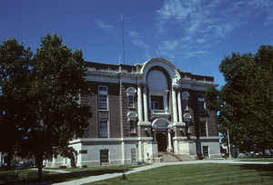
Phelps County is a county located in the state of Nebraska. Based on the 2010 census, the population was 9,188. Its county seat is Holdrege. The county was formed in 1873 and named after William Phelps, an early settler in this area
Etymology - Origin of Phelps County Name
The county was named Phelps, after former Mississippi Riverboat Captain William Phelps, who it is said settled in the area.
Demographics:
County QuickFacts: CensusBureau Quick Facts
Phelps County History
The Platte River played a significant
role in the early development of Phelps County. The Oregon Trail and Pony
Express route passed along the south bank of the river and brought many
travelers and freight shipments through the area in the mid 1800s. Soil
conditions found in this area prompted many to homestead here. One of those was
Moses Sydenham, who maintained a ranch and post office he called Hopeville in
what today is the northeast corner of the county.
Like other locales in this part of the territory, the area was not without
conflicts between Native Americans and settlers. While these attacks forced many
settlers to leave, Sydenham resisted. He took his family to an island on the
Platte River, then returned to Hopeville and hoisted a Union flag to give the
impression that soldiers where stationed there. Hopeville was never attacked.
Within a few years the settlers returned to the area. By 1873 the area's
population prompted Gov. Robert W. Furnas to proclaim a special election to
organize the county and elect officials. The county was named Phelps, after
former Mississippi Riverboat Captain William Phelps, who it is said settled in
the area. Williamsburg, in the northwest corner of the county, became the county
seat.
In 1878 the first in a series of fights took place to relocate the county seat.
Phelps Center, in the heart of the county, and Sacramento, in the southeast
corner, brought the question to a vote of the people. Neither location garnered
enough votes. In an election the following year, Phelps Center was victorious.
When a railroad branch line passed through the county, the "Magic City of the
Plains" sprung up along the line. Named in honor of George Holdrege, the
construction superintendent for the railroad, it too entered the contest to
become county seat. After local businessmen took it upon themselves to build a
courthouse, county voters agreed in 1884 that the county offices should be moved
from Phelps Center to Holdrege.
Geography: Land and Water
As reported by the Census Bureau, the county has a total area of 540 square miles (1,400 km2), of which 540 square miles (1,400 km2) is
land and 0.6 square miles (1.6 km2) (0.1%) is water.
Neighboring Counties
Bordering counties are as follows:
- Kearney County (east)
- Franklin County (southeast)
- Harlan County (south)
- Furnas County (southwest)
- Gosper County (west)
- Dawson County (northwest)
- Buffalo County (northeast)
Education


Click Image to Enlarge
