


Click Image to Enlarge
Nebraska Counties
There is ninety-three counties in state of Nebraska. Despite the fact that Sarpy County contained the oldest settlement in the state, it was one of the last lands along the river to be recognized by law. Finally, on February 1, 1857, the land "where the cities meet the country" was officially created.Sheridan County, Nebraska
Sheridan County Education, Geography, and History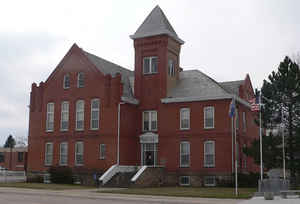
Sheridan County is a county located in the state of Nebraska. Based on the 2010 census, the population was 5,469. Its county seat is Rushville. The county was formed in 1885 and named after General Philip H. Sheridan.
Etymology - Origin of Sheridan County Name
Sheridan County being named in honor of Civil War Gen. Philip H. Sheridan, who had once lead cavalry troops against Indian raids in the Nebraska Territory.
Demographics:
County QuickFacts: CensusBureau Quick Facts
Sheridan County History
Sheridan County was once part of a
larger block of unorganized territory with no administrative, judicial or taxing
structure. Known in the early 1800s as the Sioux Territory that stretched from
Holt County to the Wyoming state line, it was for a time attached to Cheyenne
County for administrative and judicial purposes.
The first white settlement in what would become Sheridan County was recorded in
1881 northwest of the present site of Rushville. Settlers of this time took
squatter's rights, later filing claims with the US Land Office that was
located in Valentine.
In February 1885 the Legislature established the boundaries for three new
counties in Northwest Nebraska - Sioux, Dawes and Sheridan. In July of that
same year, Gov. James W. Dawes proclaimed the counties' formal creation, with
Sheridan County being named in honor of Civil War Gen. Philip H. Sheridan, who
had once lead cavalry troops against Indian raids in the Nebraska Territory. The
governor's proclamation named the settlement of Rushville as the temporary
county seat.
At the time Sheridan County was organized and the land opened for homesteading,
the railroad extended only as far west as Valentine. From that point the early
settlers would travel to this new land by wagons pulled by teams of horses or
oxen. Most early settlers lived in tents, dugouts or sod houses.
During those early development years, an impassioned contest took place for the
county seat. Rushville was joined by Gordon, Hay Springs and Clinton in seeking
this honor. In a September 1885 election, Rushville and Hay Springs became the
finalists. But accusations of fraudulent voting cast doubt about which location
had actually won. When the votes were canvassed, Hay Springs was declared the
winner. Rushville partisans took the matter to court and nearly one year later
the Supreme Court ordered the canvassing board to reconvene and canvass the vote
as it was sent in. This time Rushville was declared the winner.
Geography: Land and Water
As reported by the Census Bureau, the county has a total area of 2,470 square miles (6,400 km2), of which 2,441 square miles (6,320 km2)
is land and 29 square miles (75 km2) (1.2%) is water.
It is the fourth-largest county in Nebraska by area.
Neighboring Counties
Bordering counties are as follows:
- Oglala Lakota County, South Dakota - north
- Cherry County - east
- Grant County - southeast
- Garden County - south
- Morrill County - southwest
- Dawes County - west
- Box Butte County - west
Education


Click Image to Enlarge
