


Click Image to Enlarge
Nebraska Counties
There is ninety-three counties in state of Nebraska. Despite the fact that Sarpy County contained the oldest settlement in the state, it was one of the last lands along the river to be recognized by law. Finally, on February 1, 1857, the land "where the cities meet the country" was officially created.Stanton County, Nebraska
Stanton County Education, Geography, and History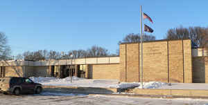
Stanton County is a county located in the state of Nebraska. Based on the 2010 census, the population was 6,129. Its county seat is
Stanton. The county was formed in 1856 and later organized in 1867. It was first called Izard County until 1862, when it was renamed for Edwin
M. Stanton, Secretary of War during the administration of President Abraham Lincoln.
Stanton County is part of the Norfolk, NE Micropolitan Statistical Area.
Etymology - Origin of Stanton County Name
In 1856 the Territorial Legislature defined boundaries for what was to be called Izard County, in honor of Mark W. Izard who was Nebraska's territorial governor at the time. The county would remain unorganized for some time and in 1862 the county boundaries would be redefined. The legislative act which redefined the county's boundaries also changed the county's name to Stanton, after Edward M. Stanton, who served as Secretary of War under President Abraham Lincoln.
Demographics:
County QuickFacts: CensusBureau Quick Facts
Stanton County History
Although Stanton County was
officially created in 1862, it would not be formally organized until five years
later when the first local election was conducted.
Early settlers in the county were of German heritage. As word spread of quality
land being available for low prices, the county's population steadily increased
along the Elkhorn River and the rolling hills that surround it. These settlers
were determined to make a living off the land and soon large areas within the
county's boundaries had been cultivated.
The first large-scale attempt at farming and livestock production came in 1867,
when an entire township was purchased. It later became known as Township Farm
and is credited with the early development of the county's agricultural base.
This population increase led to the need of a courthouse. After some controversy
about where a county seat should be located, county commissioners directed that
a temporary courthouse be built in the townsite of Stantonville, which was later
shortened to Stanton. In May 1871 a contract was let and a 350-square-foot frame
building was erected. Because of its small size, this first courthouse would be
occupied only by the office of the county clerk.
In 1874 additional room was needed for the county to conduct its business.
Efforts were begun to build a new courthouse, which opened that same year. This
building would be used until 1976, when county officials moved in the present
courthouse.
Geography: Land and Water
As reported by the Census Bureau, the county has a total area of 431 square miles (1,120 km2), of which 428 square miles (1,110 km2) is
land and 3.1 square miles (8.0 km2) (0.7%) is water
Neighboring Counties
Bordering counties are as follows:
- Cuming County (east)
- Colfax County (south)
- Platte County (southwest)
- Madison County (west)
- Wayne County (north)
Education


Click Image to Enlarge
