Nebraska Counties
There is ninety-three counties in state of Nebraska. Despite the fact that Sarpy County contained the oldest settlement in the state, it was one of the last lands along the river to be recognized by law. Finally, on February 1, 1857, the land "where the cities meet the country" was officially created.Thurston County, Nebraska
Thurston County Education, Geography, and History
Thurston County is a county located in the state of Nebraska. Based on the 2010 census, the population was 6,940. Its county seat is Pender
Etymology - Origin of Thurston County Name
Named after US Sen. John M. Thurston of Nebraska.
Demographics:
County QuickFacts: CensusBureau Quick Facts
Thurston County History
Almost a decade before Nebraska
became a state, the federal government established a reservation for the Omaha
Indian tribe in what today is Thurston County, as well as small portions of
Dixon, Burt and Cuming Counties. Eventually the northern half of the reservation
was purchased from the Omahas for use as a reservation for the Winnebago tribe.
The two reservations are still in existence today and cover the entire Thurston
County area.
The county's boundaries were established in 1855 by the Territorial Legislature.
For a time the area was referred to as Blackbird County, in honor of Omaha
Indian Chief Blackbird. When legislators attempted to formally name the county
Blackbird in 1887, Gov. John Thayer vetoed the proposal. Two years later the
Legislature adopted an act establishing the county's present boundaries and
officially naming it after US Sen. John M. Thurston of Nebraska.
There is an interesting footnote regarding Chief Blackbird. One of his favorite
campsites was located on a hill overlooking the Missouri River. According to
Indian legend, when Chief Blackbird died his followers seated him on his horse
and buried him at this site.
Federal government officials opened a portion of the Omaha Reservation to white
settlers in 1884. The following year the area's first village was established.
Buildings from the hamlet of Athens were moved to what is now Pender, the county
seat, about two miles to the northwest.
With the passage of the railroads through Thurston County in the early 1900s,
additional communities began to be established. One of those communities is
Emerson, located in the far northwest corner of the county. Emerson is unique in
that it is actually Nebraska's only tri-county community, with sections actually
platted in Thurston, Dixon and Dakota counties. Visitors who attempt to locate
the exact spot where than can stand and be in all three counties have a
difficult time, however, since it is located on Main Street, which is also a
state highway.
Geography: Land and Water
As reported by the Census Bureau, the county has a total area of 396 square miles (1,030 km2), of which 394 square miles (1,020 km2) is
land and 2.5 square miles (6.5 km2) (0.6%) is water.
The land area of the county is completely comprised from the Omaha and Winnebago Indian reservations.
Neighboring Counties
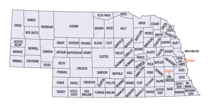
Bordering counties are as follows:
- Dakota County - north
- Woodbury County, Iowa - northeast
- Monona County, Iowa - east
- Burt County - southeast
- Cuming County - southwest
- Wayne County - west
- Dixon County - northwest
Education


