

Click Image to Enlarge
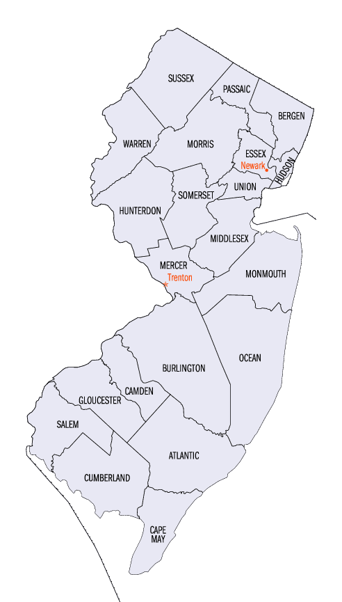
New Jersey Counties
New Jersey has twenty-one counties. New Jersey's first counties were created as administrative districts within each province, with East Jersey split in 1675 into Bergen, Essex, Middlesex and Monmouth counties, while West Jersey's initial counties of Burlington and Salem date to 1681. The most recent county created in New Jersey was Union County, created in 1857.Mercer County, New Jersey
Mercer County Education, Geography, and History
Mercer County is a county located in the state of New Jersey. As of 2014, Mercer County's Census-estimated population was 371,537. The
county was formed by an Act of the New Jersey Legislature on February 22, 1838, from portions of Burlington County (including Nottingham
Township), Hunterdon County (including Ewing Township, Lawrence Township, Trenton City and portions of Hopewell Township), and Middlesex
County (including West Windsor Township and portions of East Windsor Township). The old Keith Line bisects the county and is the boundary
between municipalities that previously had been separated into West Jersey and East Jersey. Its
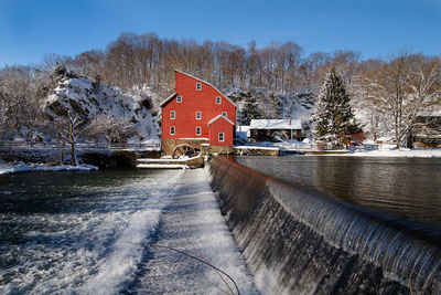
county seat is Trenton, the state capital. Mercer is named for Hugh Mercer, an American Revolutionary War general.
The county is part of the Trenton, NJ Metropolitan Statistical Area and is considered part of the New York metropolitan area by the United
States Census Bureau, but also directly borders the Philadelphia metropolitan area and is included within the Federal Communications
Commission's Philadelphia Designated Market Area.
Etymology - Origin of Mercer County Name
Mercer County was named for Continental Army General Hugh Mercer, who died as a result of wounds received at the Battle of Princeton on January 3, 1777. The Mercer Oak, against which the dying general rested as his men continued to fight, appears on the county seal and stood for 250 years until it collapsed in 2000.
Demographics:
County QuickFacts: CensusBureau Quick Facts
Mercer County History
In 1786, after General Washington ensured that Trenton would not be the national capital, and before Washington D. C.
was created, a petition was circulated around among the leaders of Burlington and Hunterdon Townships. The petition
called for the creation of the City of Trenton. Unlike its original hamlet configuration, the City of Trenton would not
be allowed to act as its cousins of the time, creating the necessary government and community atmospheres of the cities
of the 18th century.
This petition failed, but a compromise struck in the political manner of the day did create the Borough of South
Trenton. This new borough cut between Hunterdon and Burlington and made for interesting political discontent. Unhappy
with the 50 year old system of the 13 original New Jersey counties, the state legislature saw the new Borough as the
starting point of a new county - one that would balance the power of the more northern Hudson county, while still
enabling the southern counties a powerful voice in the state legislature.
In 1838, twenty three years before the Civil War, the New Jersey state legislature decided to redraw its county lines.
Increasing the colonial 13 counties to a more modern 15 counties balanced the political powers of the day. Unhappy with
the odd number of representatives in the county system, the state legislature created Mercer County.
The new county, which encompassed Princeton and Trenton, was carved out of parts of Hunterdon, Burlington, Middlesex,
and Somerset counties. This was the birth of modern day Mercer County.
The name of Mercer was given to land in honor of General Hugh Mercer, a Revolutionary General who fell at the Battle of
Princeton.
Trenton once again became a seat of power; this time as the county seat. The prosperity that the region was about to
enjoy could never have been imagined at this time, but the work that was done in 1838 led to the creation of one of the
most powerful and economically important cities in 19th and early 20th century America. Mercer County, it seems, has
always been the place where history is made, and adventure takes place.
Geography: Land and Water
According to the 2010 Census, the county had a total area of 228.89 square miles (592.8 km2), including 224.56 square miles (581.6 km2) of
land (98.1%) and 4.33 square miles (11.2 km2) of water (1.9%).
The county is generally flat and low-lying on the inner coastal plain with a few hills closer to the Delaware River. Baldpate Mountain, near
Pennington, is the highest hill, at 480 feet (150 m) above sea level. The lowest point is at sea level along the Delaware.
Neighboring Counties
Bordering counties are as follows:
- Somerset County, New Jersey - north
- Middlesex County, New Jersey - northeast
- Monmouth County, New Jersey - east
- Burlington County, New Jersey - south
- Bucks County, Pennsylvania - west
- Hunterdon County, New Jersey - northwest
Education


Click Image to Enlarge
