

Click Image to Enlarge
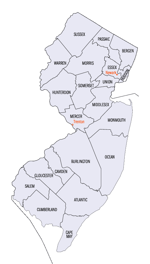
New Jersey Counties
New Jersey has twenty-one counties. New Jersey's first counties were created as administrative districts within each province, with East Jersey split in 1675 into Bergen, Essex, Middlesex and Monmouth counties, while West Jersey's initial counties of Burlington and Salem date to 1681. The most recent county created in New Jersey was Union County, created in 1857.Monmouth County, New Jersey
Monmouth County Education, Geography, and History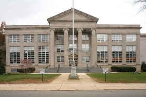
Monmouth County is a county located in Central New Jersey, in the United States within the New York metropolitan area and located in the central part of the state. It is the northernmost county along the Jersey Shore. Based on the 2010 census, the population was 630,380. Its county seat is Freehold Borough.
Etymology - Origin of Monmouth County Name
Monmouth is named for Monmouthshire, Wales.
Demographics:
County QuickFacts: CensusBureau Quick Facts
Monmouth County History
An English navigator, Henry Hudson, and his crew aboard the Dutch vessel Half Moon, in 1609, spotted land in what
is now Monmouth County, most likely off Sandy Hook; however, some historical accounts credit this landing to present-day Keansburg. Among the
first European settlers in the area were a group of Quaker families from Long Island who settled the Monmouth Tract, an early land grant from
Richard Nicolls issued in 1665 They were followed by a group of Scottish settlers who inhabited Freehold Township in about 1682-85, followed
several years later by Dutch settlers. As they arrived in this area, they were greeted by Lenape Native Americans, who lived in scattered
small family bands and developed a largely amicable relationship with the new arrivals. Enslaved Africans were present in the area from at
least 1680, and by 1726 made up 9% of the total population of the county.
Monmouth County was established on March 7, 1683, while part of the province of East Jersey. On October 31, 1693, the county was partitioned
into the townships of Freehold, Middletown and Shrewsbury. Its name may come from the Rhode Island Monmouth Society or from a suggestion from
Colonel Lewis Morris that the county should be named after Monmouthshire in Wales, Great Britain. Other suggestions include that it was named
for James Scott, 1st Duke of Monmouth (1649 - 1685), who had many allies among the East Jersey leadership. In 1714, the first county government
was established.
At the June 28, 1778, Battle of Monmouth, near Freehold Township, General George Washington's soldiers battled the British under Sir Henry
Clinton, in the longest land battle of the American Revolutionary War. It was at Monmouth that the tactics and training from Friedrich Wilhelm
von Steuben developed at Valley Forge during the winter encampment were first implemented on a large scale.
At independence, Monmouth's population included 1,640 slaves, as well as an undetermined number of free African Americans. The number of
enslaved persons fell steeply after 1820, though a small number remained until at least 1850. Monmouth's free African American population
climbed from 353 in 1790 to 2,658 in 1860.
Geography: Land and Water
According to the 2010 Census, the county had a total area of 665.32 square miles (1,723.2 km2), including 468.79 square miles (1,214.2 km2)
of land (70.5%) and 196.53 square miles (509.0 km2) of water (29.5%).
Much of Monmouth County remains flat and low-lying even far inland. However, there are some low hills in and around Holmdel Township, and one
of them, Crawford Hill, the former site of a radar facility, is the county's highest point, variously listed at 380 to 391 feet (116 to 119 m)
above sea level. The top portion of the hill is owned by Alcatel-Lucent and houses a research laboratory of Bell Laboratories. The
northeastern portion of the county, in the Locust neighborhood of Middletown Township and the boroughs of Highlands and Atlantic Highlands,
are also very hilly. The lowest point is sea level.
Neighboring Counties
Bordering counties are as follows:
- Middlesex County, New Jersey - northwest
- Ocean County, New Jersey - south
- Mercer County, New Jersey - west
- Burlington County, New Jersey - southwest
Education


Click Image to Enlarge
