

Click Image to Enlarge
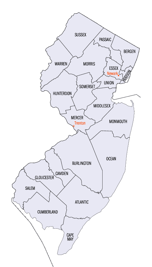
New Jersey Counties
New Jersey has twenty-one counties. New Jersey's first counties were created as administrative districts within each province, with East Jersey split in 1675 into Bergen, Essex, Middlesex and Monmouth counties, while West Jersey's initial counties of Burlington and Salem date to 1681. The most recent county created in New Jersey was Union County, created in 1857.Morris County, New Jersey
Morris County Education, Geography, and History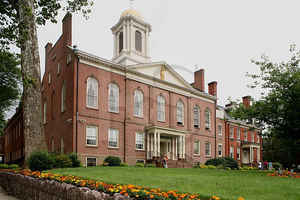
Morris County is a county located in the state of New Jersey, about 25 mi (40 km) west of New York City. According to the 2010 United
States Census, the population was 492,276. Its county seat is Morristown. Morris County was named after Colonel Lewis Morris, governor of New
Jersey in 1738/9, the year the county was named
The county is part of the New York Metropolitan Area.
Etymology - Origin of Morris County Name
Morris is named for Lewis Morris, the colonial Governor of New Jersey from 1738 to 1746.
Demographics:
County QuickFacts: CensusBureau Quick Facts
Morris County History
European settlements began in the early 18th century while it was known as Hunterdon County. Native Americans were
still in the area at that time. Land was purchased from the Native Americans for various things such as blankets, shirts, rum, guns, knives,
pots and gunpowder. The Native Americans' concept of selling land was different than that of the Europeans. Colonization occurred along the
Atlantic coast and moved inland.
The first settlement in the area today known as Morris County occurred in Pompton Plains by the Dutch in 1695. From 1710 to 1730, various iron
mines and forges were established. The first was in Whippany in 1710 and then in Succasunna in 1713.
By 1750, nearly all Native Americans had left New Jersey. This was due to land purchases from the Native Americans, diseases that the Native
Americans contracted from Europeans, and due to starvation from the Little Ice Age, during which Native American corn crops failed and rivers
froze, preventing fishing. Snow storms sent game into semi-hibernation or made them difficult to find. Nut crops such as oak, hickory, beech,
walnut, chestnut and butternut failed some years due to late frosts in spring. Due to all the events that happened, Native Americans went to
eastern Canada and others went to the Ohio Valley. The Walking Purchase in September 1737, prevented Native Americans from going to eastern
Pennsylvania. At that time, European settlement grew swiftly as there was now land to be farmed and settled.
Morris County was originally part of Burlington County which was established in 1694. Hunterdon county separated from Burlington County.
Morris County was created on March 15, 1739, from portions of Hunterdon County. The county was named for the Governor of the Province of New
Jersey, Colonel Lewis Morris.[ In later years Sussex County (on June 8, 1753) and, after the revolution, Warren County (on November 20, 1824,
from portions of Sussex County) were carved out of what had been the original area of Morris County under English rule.
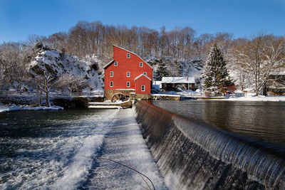
The county was the site of the winter camp of the Continental Army after the Battles of Trenton and Princeton during the winter of 1777, as
well as another winter camp at Jockey Hollow during an extremely cold winter of 1779 - 80.
Geography: Land and Water
According to the 2010 Census, the county had a total area of 481.62 square miles (1,247.4 km2), including 460.18 square miles (1,191.9 km2)
of land (95.5%) and 21.45 square miles (55.6 km2) of water (4.5%).
The county rises in elevation and relief from east to west, with only the more developed eastern suburbs in the Passaic River valley being
relatively level. The highest point is at 1,395 feet (425 m) above sea level on a mountain south of Pine Swamp in western Jefferson Township.
The second-highest point is on a mountain just north of Riker Lake at 1,358 feet (414 m). The lowest point is about 160 feet (49 m) in
elevation, at Two Bridges, the confluence of the Passaic and Pompton rivers.
The county is drained by several rivers. The Rockaway River drains 125 square miles (320 km2), of the northern section of the county. The
Whippany River drains 69 square miles (180 km2) of the middle of the county. The South Branch of the Raritan River and the Black River drain
the western area. The Loantaka Brook Reservation is a public park with nature, biking, jogging and horse paths, to which 105 acres (42 ha) of
land was added as part of a purchase in 2009.
Most of the county's borders are rivers. The Pequannock River drains the northern boundary area. The Pompton River drains the eastern section.
The Passaic River also drains the eastern border area. The western border is drained by the Musconetcong River.
There are several large lakes in Morris County, among them are Lake Hopatcong, Budd Lake, Lake Parsippany, and the Jersey City Reservoir.
Neighboring Counties
Bordering counties are as follows:
- Sussex County - north
- Passaic County - northeast
- Essex County - east
- Union County - southeast
- Somerset County - south
- Hunterdon County - southwest
- Warren County - west
Education
The County College of Morris is a two-year public community college serving students from Morris County, with its main campus in Randolph
and was founded in 1965. Another two-year college, the private Roman Catholic women's college Assumption College for Sisters, is in Mendham.
The Florham Park-Madison-Convent Station area is also the home of three universities. The Florham Campus of Fairleigh Dickinson University, is
located on the border of these three municipalities. Drew University is a small, private university in Madison. The College of Saint Elizabeth
is a private Roman Catholic, four-year, liberal arts women's college located in Convent Station.


Click Image to Enlarge
