


Click Image to Enlarge
Oklahoma Counties
There are seventy-seven counties in Oklahoma. Oklahoma originally had seven counties when it was first organized as the Oklahoma Territory. These counties were designated numerically, first through seventh. New counties added after this were designated by letters of the alphabet. The first seven counties were later renamed. The Oklahoma Constitutional Convention named all of the counties that were formed when Oklahoma entered statehood in 1907. Only two counties have been formed since thenAlfalfa County, Oklahoma
Alfalfa County Education, Geography, and History
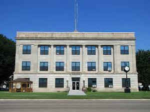
Alfalfa County is a county located in the state of Oklahoma. Based on the 2010 census, the population was 5,666. Its county seat is Cherokee. Alfalfa County was formed in 1907 from Woods County. The county is named after William H. "Alfalfa Bill" Murray, the president of the Oklahoma Constitutional Convention and ninth governor of Oklahoma.
Etymology - Origin of Alfalfa County Name
said to have been named in honor of "Alfalfa Bill" Murray, president of the Constitutional Convention by promoters who desired his support.
Demographics:
County QuickFacts: CensusBureau Quick Facts
Alfalfa County History
Indigenous peoples inhabited and hunted in this area for thousands of years. By 1750, the Osage had become a dominant tribe in the area. About one third belonged to the band led by Chief Black Dog (Manka - Chonka). Before 1800 they made the Black Dog Trail starting east of Baxter Springs, Kansas and going northwest to their summer hunting grounds at the Great Salt Plains in present-day Alfalfa County. The Osage stopped at the springs for its healing properties on their way to hunting at the plains, which attracted migratory birds and varieties of wildlife. The Osage name for this fork of the Arkansas River was Nescatunga (big salt water), what European-Americans later called the Salt Fork. The Osage cleared the trail of brush and large rocks, and made ramps at the fords. Wide enough for eight men riding horses abreast, the trail was the first improved road in Kansas and Oklahoma.
Oklahoma History Center
Situated in north-central Oklahoma in the state's northernmost tier of counties, Alfalfa County lies in a
wheat-producing region. The county's name reflects the crops of alfalfa hay once produced there and also references Gov.
William "Alfalfa Bill" Murray, who was instrumental in dividing Woods County into three counties, one of which was
Alfalfa. The land has rolling hills, meandering rivers, and grassy prairie plains, also called the Red Bed Plains. Land
and water area total 881.44 square miles. Bordered by Kansas on the north, the county abuts Woods County on the west,
Major County on the south, and Grant and Garfield counties on the east. Near the county's center is the Great Salt
Plains, both a federal wildlife refuge and a state park. It lies in the drainage of the Salt Fork of the Arkansas River,
which crosses the county from west to east, and the two are the county's major surface features. Southern Alfalfa County
drains south into the Cimarron River....ALFALFA
COUNTY
Geography: Land and Water
As reported by the Census Bureau, the county has a total area of 881 square miles (2,280 km2), of which 866 square miles (2,240 km2) is land and 15 square miles (39 km2) (1.7%) is water. It is part of the Red Bed plains. Great Salt Plains Lake and Great Salt Plains National Wildlife Refuge lie within the county. The major streams in the county are the Salt Fork of the Arkansas River and the Cimarron River.
Neighboring Counties
Bordering counties are as follows:
- Harper County, Kansas (northeast)
- Grant County (east)
- Garfield County (southeast)
- Major County (south)
- Woods County (west)
- Barber County, Kansas (northwest)
Education


Click Image to Enlarge
