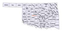
Oklahoma Counties
There are seventy-seven counties in Oklahoma. Oklahoma originally had seven counties when it was first organized as the Oklahoma Territory. These counties were designated numerically, first through seventh. New counties added after this were designated by letters of the alphabet. The first seven counties were later renamed. The Oklahoma Constitutional Convention named all of the counties that were formed when Oklahoma entered statehood in 1907. Only two counties have been formed since thenCaddo County, Oklahoma
Caddo County Education, Geography, and History

Caddo County is a county located in the state of Oklahoma. Based on the 2010 census, the population was 29,600. Its county seat is Anadarko. Created in 1901 as part of Oklahoma Territory, the county is named for the Caddo tribe who were settled here on a reservation in the 1870s. Caddo County is immediately west of the seven-county Greater Oklahoma City metro area, and although is not officially in the metro area, it has many economic ties in this region.
Etymology - Origin of Caddo County Name
Named for the Caddo tribe of Indians. The name is said to have meant "principal people" in their own language.
Demographics:
County QuickFacts: CensusBureau Quick Facts
Caddo County History
Caddo County was organized on August 6, 1901, when the Federal Government allotted the Kiowa, Comanche and Arapaho reservations and sold the surplus land to white settlers. The reservation land was part of Oklahoma Territory until Oklahoma became a state on November 16, 1907. Part of its land was taken at statehood to form neighboring Grady County. Some additional land was taken in 1911 and also awarded to Grady County.
Oklahoma History Center
Located in west-central Oklahoma, Caddo County is bordered on the north by Blaine and Canadian counties, on the east
by Grady County, on the south by Comanche County, and on the west by Kiowa, Washita, and Custer counties. Most of Caddo
County is situated in the Gypsum Hills and Red Bed Plains physiographic regions with the exception of the far
southwestern corner that lies in the Wichita Mountains region. Comprised of 1,290.31 square miles of land and water, the
county is drained by the Washita River and various creeks such as Sugar and Pond. The Canadian River passes through the
northeastern corner of Caddo County. Streams have cut deep canyons such as Red Rock Canyon near Hinton and Devil's
Canyon near Lookeba. Outcrops south of Hydro are known as the Twin Mounds, Ghost Mound, Dead Woman Mound, and Rock Mary.
At the turn of the twenty-first century incorporated towns included Anadarko, the county seat, Apache, Binger,
Bridgeport, Carnegie, Cement, Cyril, Eakly, Fort Cobb, Gracemont, Hinton, Hydro, and Lookeba....CADDO
COUNTY
Geography: Land and Water
As reported by the Census Bureau, the county has a total area of 1,290 square miles (3,300 km2), of which 1,278 square miles
(3,310 km2) is land and 12 square miles (31 km2) (0.9%) is water
The county mostly lies in the Gypsum Hills and the Red Bed plains physiographic areas. The extreme southwestern corner is in the Wichita
Mountains. The county is drained by the Washita River and Pond and Sugar Creeks. Major reservoirs are Chickasha Lake, Ellsworth Lake, and Fort
Cobb Lake, Red Rock Canyon State Park near Hinton is notable for having the only remaining stand of native Caddo maple trees.
Neighboring Counties
Bordering counties are as follows:
- Blaine County (north)
- Canadian County (northeast)
- Grady County (east)
- Comanche County (south)
- Kiowa County (southwest)
- Washita County (west)
- Custer County (northwest)
Education


