


Click Image to Enlarge
Oklahoma Counties
There are seventy-seven counties in Oklahoma. Oklahoma originally had seven counties when it was first organized as the Oklahoma Territory. These counties were designated numerically, first through seventh. New counties added after this were designated by letters of the alphabet. The first seven counties were later renamed. The Oklahoma Constitutional Convention named all of the counties that were formed when Oklahoma entered statehood in 1907. Only two counties have been formed since thenCleveland County, Oklahoma
Cleveland County Education, Geography, and History
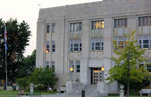
Cleveland County is a county in the central part of the state of Oklahoma. The population was 255,755 Based on the 2010 census, making it the
third-most populous county in Oklahoma. Its county seat is Norman. The county was named after US President Grover Cleveland.
Cleveland County is part of the Oklahoma City, OK Metropolitan Statistical Area.
Etymology - Origin of Cleveland County Name
Named for President Grover Cleveland.
Demographics:
County QuickFacts: CensusBureau Quick Facts
Cleveland County History
Originally occupied by the Quapaw tribe, the Quapaw ceded the area to the US Government soon after the Louisiana
Purchase in 1818. During the late 1820s and 1830s, the area was given to the Creek and Seminole tribes after their forced removal from the
southeastern United States. An agreement between the two tribes resulted in this area being part of the Seminole Nation, located west of the
Creek Nation.
In 1866, these tribes were forced to cede the area to the Federal Government for siding with the Confederacy during the American Civil
War[citation needed]. The area became part of the Unassigned Lands and was opened for white settlement on April 22, 1889.
After the passage of the Organic Act in 1890, Cleveland County was organized as County 3 and Norman became the county seat. For a short time,
Cleveland County was known as Little River County, until an election in 1890. The voters selected the name Cleveland in honor of President
Grover Cleveland over the name Lincoln
Oklahoma History Center
Situated in central Oklahoma, Cleveland County is bounded by Oklahoma County on the north, Pottawatomie County on the
east, McClain County on the south, and Canadian County on the west. Named for former Pres. Grover Cleveland, the county
lies in the Red Bed Plains physiographic region except for the southern corner, which is situated in the Sandstone
Hills. The county's total land and water area of 558.34 square miles is drained by the Little River and the Canadian
River, which forms the southern boundary. The county is characterized by rolling prairies and rich river bottom soil. At
the turn of the twenty-first century incorporated towns included Etowah, Hall Park, Lexington, Moore, Noble,
Slaughterville, and Norman, the county seat....CLEVELAND
COUNTY
Geography: Land and Water
As reported by the Census Bureau, the county has a total area of 558 square miles (1,450 km2), of which 539 square miles
(1,400 km2) is land and 19 square miles (49 km2) (3.5%) is water.
It is the seventh smallest county in the state.
Cleveland County contains the reservoir Lake Thunderbird 5,349 acres (21.65 km2), constructed between 1962 and 1965.
Cleveland County is the origin of the Little River, a tributary of the Canadian River, 90 miles (140 km) long. The Canadian River defines the
southern border of Cleveland County.
Neighboring Counties
Bordering counties are as follows:
- Oklahoma County (north)
- Pottawatomie County (east)
- McClain County (southwest)
- Canadian County (northwest)
Education
The University of Oklahoma is located in Norman. It is the largest university in Oklahoma with approximately 30,000 students.


Click Image to Enlarge
