


Click Image to Enlarge
Oklahoma Counties
There are seventy-seven counties in Oklahoma. Oklahoma originally had seven counties when it was first organized as the Oklahoma Territory. These counties were designated numerically, first through seventh. New counties added after this were designated by letters of the alphabet. The first seven counties were later renamed. The Oklahoma Constitutional Convention named all of the counties that were formed when Oklahoma entered statehood in 1907. Only two counties have been formed since thenCotton County, Oklahoma
Cotton County Education, Geography, and History
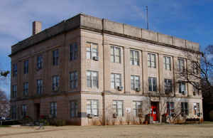
Cotton County is a county located in the state of Oklahoma. Based on the 2010 census, the population was 6,193. Its county seat is Walters.
When Oklahoma achieved statehood in 1907, the area which is now Cotton County fell within the boundaries of Comanche County. It was split off
in 1912, becoming the last county created in Oklahoma; it was named for the county's primary crop.
Cotton County is included in the Lawton, OK Metropolitan Statistical Area.
Etymology - Origin of Cotton County Name
Named from one of the county's staple crops.
Demographics:
County QuickFacts: CensusBureau Quick Facts
Cotton County History
The eastern part of what is now Cotton County was opened to settlement by non-native Americans by the 1901
Kiowa-Comanche-Apache Opening, which distributed land by a lottery system. In 1906, the remainder of the present county, then known as the Big
Pasture was opened through a sealed bid process. Most of this territory became part of Comanche County at statehood in 1907.
In 1910, residents of the present Cotton County area tried to form a new county, named "Swanson County," but this effort failed in 1911.
Another effort in 1912 succeeded. This time, residents elected to split from Comanche County and name the new county "Cotton County," for the
primary crop in the region at the time. Randlett, Oklahoma was assigned as a temporary county seat, until a November 4, 1912 election made
Walters, Oklahoma the permanent location
Oklahoma History Center
Located in southwestern Oklahoma, Cotton County is bordered by the Red River on the south, with Tillman County on the
west, Comanche County on the north, and Stephens and Jefferson counties on the east. The topography is typical of a
plains environment, with a mixture of grasses prevalent. The western edge of the Cross Timbers invades the county's
eastern portion. The creeks and streams, including Cache Creek, drain to the southeast into the Red River. Cotton County
has 641.94 square miles of land and water....COTTON
COUNTY
Geography: Land and Water
As reported by the Census Bureau, the county has a total area of 642 square miles (1,660 km2), of which 633 square miles
(1,640 km2) is land and 9.3 square miles (24 km2) (1.4%) is water.
The eastern portion of the county is in the Cross Timbers region. Its creeks and streams drain to the southeast into the Red River, which
borders the county on the south.
Neighboring Counties
Bordering counties are as follows:
- Comanche County (north)
- Stephens County (northeast)
- Jefferson County (southeast)
- Clay County, Texas (south)
- Wichita County, Texas (southwest)
- Tillman County (west)
Education


Click Image to Enlarge
