


Click Image to Enlarge
Oklahoma Counties
There are seventy-seven counties in Oklahoma. Oklahoma originally had seven counties when it was first organized as the Oklahoma Territory. These counties were designated numerically, first through seventh. New counties added after this were designated by letters of the alphabet. The first seven counties were later renamed. The Oklahoma Constitutional Convention named all of the counties that were formed when Oklahoma entered statehood in 1907. Only two counties have been formed since thenCraig County, Oklahoma
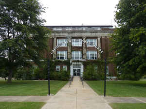
Craig County Education, Geography, and History
Craig County is a county located in the state of Oklahoma. Based on the 2010 census, the population was 15,029. Its county seat is Vinita. The county was organized in 1907, shortly before statehood, and named for Granville Craig, a prominent Cherokee farmer who lived in the Bluejacket area.
Etymology - Origin of Craig County Name
Named for Granville Craig of Welch, Oklahoma at the instance of W. H. Kornegay, delegate in the Constitutional Convention.
Demographics:
County QuickFacts: CensusBureau Quick Facts
Craig County History
In the early 1800s, this area was part of the hunting grounds of the Osage nation and other Plains tribes, some of
whom had migrated west from other areas. Members of the Cherokee Nation began moving into the area during the 1830s, particularly after Indian
Removal by the US government, which forced them on the "Trail of Tears" to west of the Mississippi River, when they were given land by the
United States in exchange for their territory in the Southeast. The area was sparsely populated until after the Civil War. The Texas Road and
the East Shawnee Cattle Trail, used for cattle drives from Texas, ran through the eastern part of the present-day Craig County.
Between 1867 and 1870, the U. S. government moved the Shawnee and Delaware tribes into this area from Kansas, another section of Indian
Territory. Then the area was assigned as part of the Delaware and Cooweescoowee districts of the Cherokee Nation, Indian Territory, after the
US government had made new treaties with the tribes that had allied with the Confederacy during the Civil War.
In 1871, the federal government took Cherokee land for the Missouri, Kansas and Texas Railroad to construct a north-south railroad through
this area, while the Atlantic and Pacific Railroad (later acquired by the St. Louis and San Francisco Railway) was allowed to build an
east-west line that ran through Vinita in the same year. This line was extended through Tulsa, Oklahoma in 1881-2.
Coal mining began in this area after the Civil War. Mine companies used both tunnel and strip mines, but they did not begin major production
until about 1900. Production has continued into the 21st century.
Other resource exploitation was based on oil, and the first oil refinery began operations by 1911; it was operated by Sinclair Oil until the
1920s. Otherwise, farming and ranching were the mainstays of the county economy.
The county was organized in 1907, at the Oklahoma Statehood Convention. It was named for Granville Craig, a prominent Cherokee farmer of mixed
race who had property near Bluejacket.
Oklahoma History Center
Craig County lies in the northeastern corner of the state. Bordering counties include Ottawa and Delaware counties on
the east, Nowata County on the west, Mayes and Rogers counties on the south, and Labette County, Kansas, on the north.
The county lies in the Osage Plains, accounting for the large area of fertile, rolling prairies. The Neosho Lowlands, a
subdivision of the Osage Plains, extends into the county's eastern and southern portions, creating a rougher
environment. The tributaries of the Neosho River drain the county, with Big Cabin Creek the main artery in southern
Craig County. By 1981 only seventeen archaeological sites had been discovered. Many of these, such as the Praytor Site
and the Heath Site, are of the Woodland (A.D. 1 to 1000) period. By A.D. 1200 most of the Caddoan culture had relocated
to the southern courses of the Neosho, Illinois, and Arkansas rivers....CRAIG
COUNTY
Geography: Land and Water
As reported by the Census Bureau, the county has a total area of 763 square miles (1,980 km2), of which 761 square miles
(1,970 km2) is land and 1.4 square miles (3.6 km2) (0.2%) is water.
The county lies in the Osage Plains, on the western edge of the Ozark Plateau, and drains into several tributaries of the Neosho River.
Neighboring Counties
Bordering counties are as follows:
- Labette County, Kansas (north)
- Cherokee County, Kansas (northeast)
- Ottawa County (east)
- Delaware County (southeast)
- Mayes County (south)
- Rogers County (southwest)
- Nowata County (west)
Education


Click Image to Enlarge
