


Click Image to Enlarge
Oklahoma Counties
There are seventy-seven counties in Oklahoma. Oklahoma originally had seven counties when it was first organized as the Oklahoma Territory. These counties were designated numerically, first through seventh. New counties added after this were designated by letters of the alphabet. The first seven counties were later renamed. The Oklahoma Constitutional Convention named all of the counties that were formed when Oklahoma entered statehood in 1907. Only two counties have been formed since thenGarvin County, Oklahoma
Garvin County Education, Geography, and History
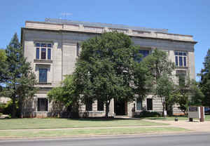
Garvin County is in south-central Oklahoma. Based on the 2010 census, the population was 27,576. Its county seat is Pauls Valley. In 1906, delegates to Constitution Convention formed Garvin County from part of the Chickasaw Nation, Indian Territory The county was named for Samuel J. Garvin, a local Chickasaw rancher, merchant and banker.
Etymology - Origin of Garvin County Name
Named for Samuel Garvin of Pauls Valley, a prominent intermarried citizen of the Chickasaw Nation.
Demographics:
County QuickFacts: CensusBureau Quick Facts
Garvin County History
An election held June 20, 1908, resulted in county citizens choosing Pauls Valley as the county seat over the towns of Wynnewood and Elmore City.
Oklahoma History Center
Delegates to the Constitutional Convention of 1906 formed Garvin County from a part of the former Recording District
17 in the Chickasaw Nation, Indian Territory. Located in south-central Oklahoma, the 813.66-square-mile county is
bordered by McClain County to the north, Pontotoc County to the east, Murray and Carter counties to the south, and
Stephens and Grady counties to the west. Incorporated towns are Pauls Valley, the county seat, Elmore City, Lindsay,
Maysville, Paoli, Stratford, and Wynnewood.
Garvin County lies within the Red Bed Plains and Sandstone Hills physiographic regions. The Washita River, Rush
Creek, and Wildhorse Creek flow southeast across rolling hills toward the Arbuckle Mountains in the south.
Interstate 35 and State Highways 74, 76, and 18 run north and south through the county, while State Highways 7, 19,
and 29 remain the principal east-west thoroughfares. At 1907 statehood the Atchison, Topeka and Santa Fe Railway
connected Paoli, Pauls Valley, and Wynnewood along the eastern edge of the county, while an east-west line linked
Pauls Valley with Lindsay. The Lindsay line was abandoned after 1978, but the north-south route remained in
operation through 1990. Starting in 1999 the Heartland Flyer, an Amtrak passenger line from Oklahoma City to Fort
Worth, Texas, stopped twice daily at Pauls Valley's restored Santa Fe depot...GARVIN
COUNTY
Geography: Land and Water
As reported by the Census Bureau, the county has a total area of 814 square miles (2,110 km2), of which 802 square miles
(2,080 km2) is land and 12 square miles (31 km2) (1.4%) is water.
The county lies between the Red Bed plains and the Sandstone Hills physiographic regions. The main waterways are the Washita River, Rush Creek
and Wildhorse Creek
Neighboring Counties
Bordering counties are as follows:
- McClain County (north)
- Pontotoc County (east)
- Murray County (southeast)
- Carter County (south)
- Stephens County (southwest)
- Grady County (northwest)
Education


Click Image to Enlarge
