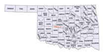
Oklahoma Counties
There are seventy-seven counties in Oklahoma. Oklahoma originally had seven counties when it was first organized as the Oklahoma Territory. These counties were designated numerically, first through seventh. New counties added after this were designated by letters of the alphabet. The first seven counties were later renamed. The Oklahoma Constitutional Convention named all of the counties that were formed when Oklahoma entered statehood in 1907. Only two counties have been formed since thenGrant County, Oklahoma
Grant County Education, Geography, and History

Grant County is a county located on the northern border of the state of Oklahoma. Based on the 2010 census, the population was 4,527. Its county seat is Medford. Originally designated as part of the Cherokee Outlet, it was named County L in Oklahoma Territory at the time of its opening to non-Indian settlement. A county election renamed it for US President Ulysses S. Grant
Etymology - Origin of Grant County Name
Named for President Ulysses S. Grant.
Demographics:
County QuickFacts: CensusBureau Quick Facts
Grant County History
Grant County was part of the Cherokee Nation's Cherokee Outlet until it was opened to non-Indian settlers in response to public demand on September 16, 1893. Settlers named the county after President Ulysses S. Grant in a general election held November 6, 1894. Congress originally designated this area as County L in Oklahoma Territory, with the county seat at Pond Creek. Medford became the county seat through an election held on May 27, 1908.
Oklahoma History Center
Grant County, located in north-central Oklahoma, lies in the most northern tier of counties bordered on the north by
the state of Kansas. Surrounded by Kay County on the east, Garfield County on the south, and Alfalfa County on the west,
Grant County has a total of 1,003.61 squares miles of land and water. Situated in the Red Bed Plains and in the Great
Salt Plains, the area is noted as a wheat-growing region. The grassy plains are drained by the Salt Fork of the Arkansas
River, which flows from west to east in the southern half of the county. North-south tributaries such as Pond, Deer,
Osage, and Crooked creeks flow into the Salt Fork. The Chikaskia River originates in the county's northeastern corner,
crossing west to east into Kay County. Grant County is included in an area of Oklahoma that is one of the state's least
studied by archaeologists. There are nine known archaeological sites. Surveys have provided the conclusion that the area
was occupied during the Archaic (6000 B.C. to A.D.1), Woodland (A.D. 1 to 1000), and Plains Village (A.D. 1000 to 1500)
cultural periods....GRANT
COUNTY
Geography: Land and Water
As reported by the Census Bureau, the county has a total area of 1,004 square miles (2,600 km2), of which 1,001 square miles
(2,590 km2) is land and 2.7 square miles (7.0 km2) (0.3%) is water.
Most of the county is drained by the Salt Fork of the Arkansas River and its tributaries (Pond, Deer, Osage, and Crooked creeks). The
Chikaskia River flows southeast from Kansas into the county's northeastern corner, then crosses east into Kay County.
The county is by the state of Kansas on the north, specifically Sumner County, Kansas, and Harper County, Kansas. Adjacent counties in
Oklahoma are Kay County to the east, Garfield County to the south, and Alfalfa County to the west.
Neighboring Counties
Bordering counties are as follows:
- Alfalfa County (west)
- Garfield County (south)
- Harper County, Kansas (northwest)
- Kay County (east)
- Noble County (southeast)
- Sumner County, Kansas (northeast)
Education


