


Click Image to Enlarge
Oklahoma Counties
There are seventy-seven counties in Oklahoma. Oklahoma originally had seven counties when it was first organized as the Oklahoma Territory. These counties were designated numerically, first through seventh. New counties added after this were designated by letters of the alphabet. The first seven counties were later renamed. The Oklahoma Constitutional Convention named all of the counties that were formed when Oklahoma entered statehood in 1907. Only two counties have been formed since thenHaskell County, Oklahoma
Haskell County Education, Geography, and History
Haskell County is a county located in the southeast quadrant of the state of Oklahoma. Based on the 2010 census, the population was 12,769. Its county seat is Stigler. The county is named in honor of Charles N. Haskell, who was the first governor of Oklahoma.
Etymology - Origin of Haskell County Name
Named for Charles N. Haskell, a member of the Constitutional Convention and later elected first governor of the state.
Demographics:
County QuickFacts: CensusBureau Quick Facts
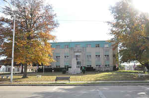
Haskell County History
The area now comprising Haskell County was created at statehood from the former San Boise County of the Choctaw Nation in Indian Territory. An election in 1908 picked Stigler over Keota and Whitefield as the county seat.
Oklahoma History Center
Located in southeastern Oklahoma, Haskell County, created at 1907 statehood, encompasses 625.27 square miles of land
and water area. The county name honors Charles N. Haskell, Oklahoma's first governor and a member of the Oklahoma
Constitutional Convention. Haskell County's 1907 population stood at 16,865, and in that year Stigler defeated Keota and
Whitefield in a competition for the county seat. At the beginning of the twenty-first century six incorporated towns
existed in the county: Stigler, Tamaha, Whitefield, Kinta, Keota, and McCurtain.,..HASKELL
COUNTY
Geography: Land and Water
As reported by the Census Bureau, the county has a total area of 625 square miles (1,620 km2), of which 577 square miles
(1,490 km2) is land and 49 square miles (130 km2) (7.8%) is water.
The county elevation varies because of the San Bois Mountains in the southern part of the county from 500 feet (150 m) to 1,500 feet (460 m).
The relatively large water area results from the presence of Eufaula Lake and the Robert S. Kerr Reservoir. The South Canadian River forms the
northern border with McIntosh and Muskogee counties before draining into the Arkansas River at the Robert S. Kerr Reservoir. The Arkansas is
the northeastern border with Sequoyah County.
Neighboring Counties
Bordering counties are as follows:
- Muskogee County (north)
- Sequoyah County (northeast)
- Le Flore County (east)
- Latimer County (south)
- Pittsburg County (west)
- McIntosh County (northwest)
Education


Click Image to Enlarge
