Oklahoma Counties
There are seventy-seven counties in Oklahoma. Oklahoma originally had seven counties when it was first organized as the Oklahoma Territory. These counties were designated numerically, first through seventh. New counties added after this were designated by letters of the alphabet. The first seven counties were later renamed. The Oklahoma Constitutional Convention named all of the counties that were formed when Oklahoma entered statehood in 1907. Only two counties have been formed since thenJefferson County, Oklahoma
Jefferson County Education, Geography, and History

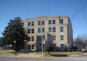
Jefferson County is a county located in the state of Oklahoma. Based on the 2010 census, the population was 6,472. Its county seat is Waurika. The county was created at statehood and named in honor of President Thomas Jefferson
Etymology - Origin of Jefferson County Name
Named for President Thomas Jefferson.
Demographics:
County QuickFacts: CensusBureau Quick Facts
Jefferson County History
In the 1750s, the Taovaya Indians, a Wichita tribe, established twin villages along the Red River, in Jefferson
County and across the river near present-day Spanish Fort, Texas. The village became 'a lively emporium where Comanches brought Apache slaves,
horses and mules to trade for French packs of powder, balls, knives, and textiles and for Taovaya-grown maize, melons, pumpkins, squash, and
tobacco.'
In 1759, in response to the destruction of the San Saba Mission, the Spanish led an expedition against the Taovaya and their allies and
attacked the twin villages. The Indians defeated the Spanish army. (See Battle of the Twin Villages) The Taovaya villages were abandoned
before 1841 as the Taovaya had been decimated by smallpox and encroachment by other Indians and Anglo-Americans.
In the 1830s, the Choctaw tribe acquired more than two-thirds of the land now covered by Jefferson County, and the closely related Chickasaw
tribe began to relocate there. In 1855, the two tribes formally divided and this area became part of the Chickasaw Nation. The western part of
the present county became part of the Kiowa-Comanche-Apache Reservation, created by the 1867 Medicine Lodge Treaty. That area was opened to
settlement by non-Indians by the Kiowa-Comanche-Apache Opening in 1901.
After the Civil War, the Chisholm Trail, which passed through this area, was heavily used to drive cattle from Texas to markets in Kansas. In
1892, the Chicago, Rock Island and Pacific Railway laid tracks along the trail route. The Enid and Anadarko Railway, sold to the Rock Island
in 1903, built a line from Lawton to Waurika. The Wichita Falls and Oklahoma Railroad built the last railroad in the county in 1923, from
Texas to Waurika. It went out of business in 1942. A railway line was built from Ardmore to Ringling.
Statehood in 1907 brought about the demise of the Chickasaw government and creation of Jefferson County. At that time the southeast corner of
the county extended to Mud Creek including the communities of Belleville and Courtney. In 1924 the southeast corner of the county was
realigned to its current boundary. The Oklahoma Constitutional Convention named Ryan as the county seat. An election for the seat was held in
1908 between Ryan, Sugden and Waurika, but none of the towns won a majority. Another election was held in 1912, resulting in Waurika being
named as the county seat.
Oklahoma History Center
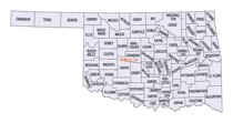
Situated in southern Oklahoma, Jefferson County is bordered on the south by the Red River and Texas, with Cotton
County on the west, Stephens County on the north, and Carter and Love counties on the east. Created at 1907 statehood,
the county was named to honor US Pres. Thomas Jefferson. The incorporated towns are Addington, Cornish, Hastings,
Ringling, Ryan, Sugden, Terral, and Waurika (the county seat).
The county lies in the Redbed Plains physiographic region, a subregion of the Osage Plains. The terrain is mainly flat
or rolling prairie. Beaver and Mud creeks and their smaller tributaries drain the county into the Red River. In 1971 the
US Army Corps of Engineers began construction on the Waurika Dam on Beaver Creek, creating Waurika Lake in
northwestern Jefferson, southwestern Stephens, and western Cotton counties....JEFFERSON
COUNTY
Geography: Land and Water
As reported by the Census Bureau, the county has a total area of 774 square miles (2,000 km2), of which 759 square miles
(1,970 km2) is land and 15 square miles (39 km2) (2.0%) is water.
The county drains into the Red River via Beaver and Mud creeks. Waurika Lake was created in 1971 by damming Beaver Creek in northwestern
Jefferson County
Neighboring Counties
Bordering counties are as follows:
- Stephens County (north)
- Carter County (northeast)
- Love County (east)
- Montague County, Texas (south)
- Clay County, Texas (southwest)
- Cotton County (west)
Education


