


Click Image to Enlarge
Oklahoma Counties
There are seventy-seven counties in Oklahoma. Oklahoma originally had seven counties when it was first organized as the Oklahoma Territory. These counties were designated numerically, first through seventh. New counties added after this were designated by letters of the alphabet. The first seven counties were later renamed. The Oklahoma Constitutional Convention named all of the counties that were formed when Oklahoma entered statehood in 1907. Only two counties have been formed since thenJohnston County, Oklahoma
Johnston County Education, Geography, and History
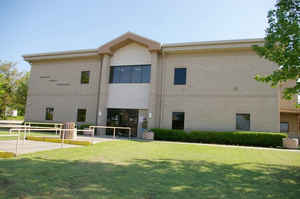
Johnston County is a county located in the state of Oklahoma. Based on the 2010 census, the population was 10,957. Its county seat is
Tishomingo. It was established at statehood on November 16, 1907 and named for Douglas H. Johnston, a governor of the Chickasaw Nation
Johnston County is part of the Texoma Region.
Etymology - Origin of Johnston County Name
Named for Douglas H. Johnston, Governor of the Chickasaw Nation.
Demographics:
County QuickFacts: CensusBureau Quick Facts
Johnston County History
In 1820, the US government granted the land now known as Johnston County to the Choctaw tribe. Many of the
Choctaws began moving to the new land in Indian Territory in 1830. The rest followed Chickasaw tribe, who were closely related to the Choctaw,
formally separated from the Choctaw Nation in the late 1830s, relocating to the western part of the Choctaw Nation. The Chickasaw Nation named
the town of Tishomingo as its capital and built a brick capitol building there in 1856.
The Chickasaw government joined the Confederate States of America after the outbreak of the Civil War. The Union army ordered its troops to
evacuate Fort Washita, Fort Cobb and Fort Arbuckle. When Confederate troops occupied the area, they used the stone building at Wapanucka as a
hospital and a prison.
Located in south-central Oklahoma, Johnston County contains 658.29 square miles of total land and water area. It is
bordered by Pontotoc County to the north, Coal and Atoka counties to the east, Bryan and Marshall counties to the south,
and Carter and Murray counties to the west. The county was created at 1907 statehood, the name honoring Douglas H.
Johnston, governor of the Chickasaw Nation in 1898-1902 and 1904-1939. Tishomingo is the county seat, and Bromide,
Mannsville, Milburn, Mill Town, Ravia, and Wapanucka are other incorporated towns. US Highway 377/State Highway 99
runs north-south through the county, connecting Ada to Tishomingo. Other state highways include 1, 7, 22, 48, 48A, and
78.
The county's northern portion lies in the Arbuckle Mountains physiographic region and is dominated by rock outcrops
and rolling hills, while the far southern section is in the Coastal Plains region, which is more suitable to
farming. The Washita and Blue rivers and Pennington Creek drain the county as part of the Red River basin. A
northern appendage of Lake Texoma protrudes into southern Johnston County, southeast of Tishomingo....JOHNSTON
COUNTY
Geography: Land and Water
As reported by the Census Bureau, the county has a total area of 658 square miles (1,700 km2), of which 643 square miles
(1,670 km2) is land and 15 square miles (39 km2) (2.3%) is water.
The northern part of the county lies in the Arbuckle Mountains, which consists of rock outcroppings and rolling hills. The southern part of
the county is part of the Coastal Plains region, and is more suitable for farming. The county is drained by the Washita and Blue Rivers and
Pennington Creek, which are all tributaries of the Red River. An arm of Lake Texoma protrudes into southern Johnston County.
Neighboring Counties
Bordering counties are as follows:
- Pontotoc County (north)
- Coal County (northeast)
- Atoka County (east)
- Bryan County (southeast)
- Marshall County (south)
- Carter County (west)
- Murray County (northwest)
Education
Murray State School of Agriculture opened in Tishomingo in 1908. In 1972 the community college's name changed to Murray State College


Click Image to Enlarge
