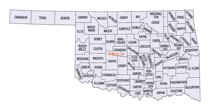
Oklahoma Counties
There are seventy-seven counties in Oklahoma. Oklahoma originally had seven counties when it was first organized as the Oklahoma Territory. These counties were designated numerically, first through seventh. New counties added after this were designated by letters of the alphabet. The first seven counties were later renamed. The Oklahoma Constitutional Convention named all of the counties that were formed when Oklahoma entered statehood in 1907. Only two counties have been formed since thenKay County, Oklahoma
Kay County Education, Geography, and History

Kay County is a county located in the state of Oklahoma. Based on the 2010 census, the population was 46,562. Its county seat is Newkirk,
and the largest city is Ponca City.
Kay County comprises the Ponca City, OK Micropolitan Statistical Area. It is in north central Oklahoma on the Kansas state line.
Before statehood, Kay County was formed from the "Cherokee Strip"or "Cherokee Outlet"and originally designated as county "K."Its name means
simply that. Kay County is the only county to keep its same name as the Oklahoma area moved from a territory to a state.
Etymology - Origin of Kay County Name
name was derived by spelling out the letter "K," which was the original official designation of the county.
Demographics:
County QuickFacts: CensusBureau Quick Facts
Kay County History
After the Civil War, the Cherokee Nation had to allow the Federal Government to relocate other Native American tribes to settle in the area known as the Cherokee Outlet, The Kansa (Kaw) arrived in June 1873, settling in what would become the northeastern part of Kay County. The Ponca followed in 1877. The Nez Perce came from the Pacific Northwest in 1879, but remained only until 1885, when they returned to their earlier homeland. Their assigned land in Oklahoma was then occupied by the Tonkawa and Lipan Apache people
Oklahoma History Center
Located in northern Oklahoma, Kay County is surrounded by Sumner and Cowley counties in Kansas to the north, Osage
County to the east, Noble County to the south, and Grant County to the west. Kay County lies within the Red Bed Plains
and encompasses 945.12 square miles of land and water. Three streams, the Chikaskia River, the Salt Fork of the Arkansas
River, and the Arkansas River, flow through the county.
At the turn of the twenty-first century the Oklahoma Archaeological Survey reported 427 archaeological sites in Kay
County. Two of those were the Bryson Archaeological Site (listed in the National Register of Historic Places, NR
79001997) and the Deer Creek Site (NR 66000630). In the mid-1700s French voyageurs from Louisiana traded with the
Wichita at these two sites. Early explorers included James B. Wilkinson and George C. Sibley, who came through the area
in 1806 and 1811, respectively. In 1843 Nathan Boone and others passed through the southwest corner of the future county
when he led an expedition from Fort Gibson to the Great Salt Plains.....KAY
COUNTY
Geography: Land and Water
As reported by the Census Bureau, the county has a total area of 945 square miles (2,450 km2), of which 920 square miles
(2,400 km2) is land and 25 square miles (65 km2) (2.7%) is water.
The highest point in Kay County, Oklahoma, is west of North Sage Lane, at greater than 1,310 feet above sea level. The northern boundary is
the border with Kansas and its eastern boundary is with Osage County. Kaw Lake, a large reservoir on the Arkansas River completed in 1975
includes most of the water area of the country. East of Kaw Lake and the Arkansas River is the region called the Osage Hills or The Osage, a
tall-grass prairie region of large livestock, mostly cattle, ranches. West of the Arkansas River the land is flatter and a mixture of
cultivated lands and livestock ranches. Principal rivers flowing through the county are the Chikaskia River, the Arkansas River and the Salt
Fork of the Arkansas River.
Neighboring Counties
Bordering counties are as follows:
- Cowley County, Kansas (north)
- Osage County (east)
- Noble County (south)
- Garfield County (southwest)
- Grant County (west)
Education


