Oklahoma Counties
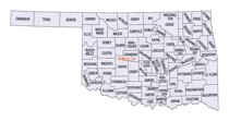
There are seventy-seven counties in Oklahoma. Oklahoma originally had seven counties when it was first organized as the Oklahoma Territory. These counties were designated numerically, first through seventh. New counties added after this were designated by letters of the alphabet. The first seven counties were later renamed. The Oklahoma Constitutional Convention named all of the counties that were formed when Oklahoma entered statehood in 1907. Only two counties have been formed since thenKingfisher County, Oklahoma
Kingfisher County Education, Geography, and History

Kingfisher County is a county located in the state of Oklahoma. Based on the 2010 census, the population was 15,034. Its county seat is
Kingfisher. The county was formed in 1890 and named Kingfisher by a vote of residents.
The land was given to the Creek Nation by the federal government, but was taken back after the American Civil War.
Etymology - Origin of Kingfisher County Name
Named for its county seat town which in turn was named for the creek. There has been a dispute as to the origin of the name of the creek. Some contend that it was named for the piscatorial bird which dives into its waters while others stoutly maintain that it was named for a cattle man, King Fisher, whose ranch headquarters were located in its valley. The facts are as follows: Two ranchmen- an uncle and nephew- by the name of Fisher were located in the vicinity of Kingfisher at an early day. The uncle had his ranch on one creek which was called, for him, Uncle John's Creek, and is so named to this day. The nephew, whose first name was King, had his ranch on the other creek and, for him, it was called and is still called King Fisher Creek.
Demographics:
County QuickFacts: CensusBureau Quick Facts
Kingfisher County History
Limited archaeological surveys may have discovered evidence of pre-contact peoples, including Paleo-Indian and
Archaic (6000 BC - 1 AD) groups that used the area for hunting and foraging. The historic Osage, Cheyenne, and Comanche tribes traversed the
prairie grasslands of this area.
Before the county's creation, The Chisholm Trail's many routes crossed the area. A stage road which paralleled the trail had important stops
at Dover Station, King Fisher Station and Baker Station.
The area was given to the Creek Nation by the federal government after their forced removal from Georgia. At the end of the American Civil
War, the Creeks were forced to cede the land back to the federal government for siding with the Confederacy. It became part of the Unassigned
Lands, and the area was opened to non-Indian settlement in the land run on April 22, 1889. Several towns, including Kingfisher, Oklahoma
developed soon after the land run.
Originally this area was called County 5, when the Organic Act of May 2, 1890 created Oklahoma Territory. At an August 5, 1890 election, the
voters of County 5 overwhelmingly voted for the name "Kingfisher" over "Hennessey" and "Harrison". The origin of the name is unclear. The
Encyclopedia of Oklahoma History and Culture mentions three different possibilities. The first is that the name memorialized a local rancher,
David King Fisher. The second version is that King and Fisher were two different settlers, whose names were combined for the county and town.
The third explanation was that the name was for a rancher named John Fisher and for whom Uncle Johns Creek was named
Oklahoma History Center
Bordered by Major and Garfield counties on the north, Logan on the east, Canadian on the south, and Blaine on the
west, Kingfisher County is crossed by US Highway 81 north-south and by State Highways 33/3 and 51 east-west. The
Cimarron River slices diagonally through the county, entering near the northwest corner and exiting into Logan County at
midboundary.
Kingfisher County's 906 square miles of land and water area lies in the Red Bed Plains of the Osage Plains physiographic
region. The topography is characterized by low, rolling hills. Before the agricultural era, prairie grasslands
prevailed, and about one-sixth of the area was covered with oak timber. The breaks of the Cimarron River and its
tributary creeks, including Turkey Creek from the north and Uncle John Creek and Kingfisher Creek from the south, are
populated with cedar and some deciduous trees. Limited archaeological surveys revealed that precontact peoples,
including Paleo-Indian and Archaic groups, may have used the area for foraging and hunting may have included Archaic-era
(6000 B.C. to 1 A.D.) groups. The historic Osage, Cheyenne, and Comanche also accessed the broad prairies as they
traveled in search of subsistence....KINGFISHER
COUNTY
Geography: Land and Water
As reported by the Census Bureau, the county has a total area of 906 square miles (2,350 km2), of which 898 square miles
(2,330 km2) is land and 7.9 square miles (20 km2) (0.9%) is water.
The principal waterway is the Cimarron River, which runs from northwest to east through the county
Neighboring Counties
Bordering counties are as follows:
- Garfield County (north)
- Logan County (east)
- Canadian County (south)
- Blaine County (west)
- Major County (northwest)
- Oklahoma County (southeast)
Education
Kingfisher Academy, affiliated with the Congregational Church, was established in Kingfisher well before statehood. It remained open between 1890 and 1894. In 1895, the Association of Congregational Churches of Oklahoma Territory chartered Kingfisher College, and opened it for instruction on September 2, 1895


