


Click Image to Enlarge
Oklahoma Counties
There are seventy-seven counties in Oklahoma. Oklahoma originally had seven counties when it was first organized as the Oklahoma Territory. These counties were designated numerically, first through seventh. New counties added after this were designated by letters of the alphabet. The first seven counties were later renamed. The Oklahoma Constitutional Convention named all of the counties that were formed when Oklahoma entered statehood in 1907. Only two counties have been formed since thenKiowa County, Oklahoma
Kiowa County Education, Geography, and History
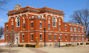
Kiowa County is a county located in the southwestern part of the state of Oklahoma. Based on the 2010 census, the population was 9,446. Its county seat is Hobart. The county was created in 1901 as part of Oklahoma Territory. It was named for the Kiowa people.
Etymology - Origin of Kiowa County Name
Named from the Indian tribe. The name is a corruption of the name "Ka-i-gwu," meaning "principal people."
Demographics:
County QuickFacts: CensusBureau Quick Facts
Kiowa County History
In 1892, the Jerome Commission began enrolling the Kiowas, Comanches and Apaches to prepare for the opening of their
reservation to settlement by whites. Dennis Flynn, the territorial representative to the U. S. Congress, proposed holding a lottery for
opening the reservation. He argued successfully that the lottery would be safer and more orderly than land runs used earlier. Individuals
could register at offices in Lawton or El Reno. 165,000 individuals registered for 13,000 160-acre claims. The drawing was held August 6,
1901. After the opening, the area was designated as Kiowa County in Oklahoma Territory. The town of Hobart, named for Vice President Garrett
A. Hobart, was designated as county seat.
By 1908, residents of the southern part of the county were already agitating for a new county to be formed. In 1910, Governor Charles N.
Haskell proclaimed that parts of Kiowa and Comanche Counties would become the new Swanson County. The new county became defunct in 1911, after
the U. S. Supreme Court voided the change.
Oklahoma History Center
Kiowa County lies in the southwestern portion of Oklahoma, surrounded by Washita County to the north, Caddo and
Comanche counties to the east, Greer and Jackson counties to the west, and Tillman County to the south. The western and
southern boundary, the North Fork of the Red River, separates Kiowa from Jackson, Greer, and Tillman. Among fifty-eight
archaeological sites reflecting the presence of prehistoric Native peoples in the county, one, the Cooperton Mammoth
Site, indicates Paleo-Indian presence. Archaic peoples are reflected in eighteen sites and Woodland occupation in one.
Thirty-eight Plains Village sites have been examined. In the modern period Spain and France claimed ownership of the
region. The area became part of the United States with the Louisiana Purchase in 1803. The Doak's Stand Treaty of 1820
gave all of southern Oklahoma to the Choctaw....KIOWA
COUNTY
Geography: Land and Water
As reported by the Census Bureau, the county has a total area of 1,031 square miles (2,670 km2), of which 1,015 square miles
(2,630 km2) is land and 15 square miles (39 km2) (1.5%) is water.
The county is largely composed of flatlands, although the southern border is covered by the Washita Mountains.
The North Fork of the Red River serves as the southern and western boundaries of Jackson County. Water bodies include Altus-Lugert Lake on the
and Tom Steed Reservoir on Otter Creek. Other streams in the county are the Washita River and Elk Creek.
Neighboring Counties
Bordering counties are as follows:
- Washita County (north)
- Caddo County (east)
- Comanche County (southeast)
- Tillman County (south)
- Jackson County (southwest)
- Greer County (west)
Education


Click Image to Enlarge
