


Click Image to Enlarge
Oklahoma Counties
There are seventy-seven counties in Oklahoma. Oklahoma originally had seven counties when it was first organized as the Oklahoma Territory. These counties were designated numerically, first through seventh. New counties added after this were designated by letters of the alphabet. The first seven counties were later renamed. The Oklahoma Constitutional Convention named all of the counties that were formed when Oklahoma entered statehood in 1907. Only two counties have been formed since thenLogan County, Oklahoma
Logan County Education, Geography, and History
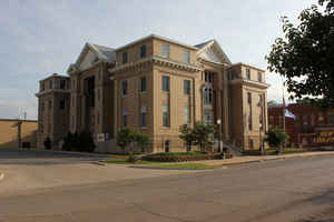
Logan County is a county located in the state of Oklahoma. Based on the 2010 census, the population was 41,848. Its county seat is Guthrie.
Logan County is part of the Oklahoma City, OK Metropolitan Statistical Area. Guthrie served as the capital of Oklahoma Territory from 1890
until 1907 and of the state of Oklahoma from 1907 until 1910.
Etymology - Origin of Logan County Name
Named for General John A. Logan.
Demographics:
County QuickFacts: CensusBureau Quick Facts
Logan County History
Logan County was created as County One by the Organic Act of 1890. The town of Guthrie was designated as the county
seat and the capital of Oklahoma Territory. The county was named on August 5, 1890 for U. S. Senator, John A. Logan, of Illinois.
The land in what became Logan County had been settled during the 1820s and 1830s by the Creek and Seminole tribes after the forced Indian
Removal by the federal government from their traditional historic territories in the American Southeast. These tribes supported the
Confederate States of America during the Civil War, in part based on the CSA promise of an American Indian state if they won. The United
States required the tribes that supported the Confederacy to make new Reconstruction Treaties in 1866.
As part of the treaties, the US reduced the lands of these tribes, designating certain areas as Unassigned Lands. This 2 million-acre area was
reserved for years after the war as potential reservation lands for the Plains tribes, who were mostly settled in other areas. Congress passed
a law in 1889, after the Indian Wars, to open the land to non-Indian settlement under terms of the 1862 Homestead Act. The land rush (or run)
took place on April 22, 1889, whereby people rushed to establish homestead plots.
The three easternmost townships were added to the county in 1891, after areas of the Sac and Fox lands were also opened to non-Indian
settlement, following allotment of communal lands to individual tribal households under implementation of the Dawes Act. This law resulted in
massive losses of Indian land. The US classified lands remaining after allotment as "surplus" and allowed them to be sold to non-Natives.
Oklahoma History Center
Located in north-central Oklahoma, Logan County is bordered by Garfield and Noble counties on the north, Payne and
Lincoln counties on the east, Oklahoma County on the south, and Kingfisher County on the west. Named for US Sen. John
A. Logan of Illinois, the county is drained by the Cimarron River and the Cottonwood and Ephraim creeks. Comprised of
twenty-one townships Logan County lies within the Red Bed Plains physiographic area. The eastern three townships of
North Cimarron, South Cimarron, and Iowa were added to Logan County after the Sac and Fox Land Opening on September 22,
1891, to comprise a total of 748.92 square miles of land and water. At the turn of the twenty-first century incorporated
towns included Cedar Valley, Cimarron City, Coyle, Crescent, Marshall, Meridian, Mulhall, Orlando, and Guthrie, the
county seat....LOGAN
COUNTY
Geography: Land and Water
As reported by the Census Bureau, the county has a total area of 749 square miles (1,940 km2), of which 744 square miles
(1,930 km2) is land and 5.0 square miles (13 km2) (0.7%) is water.
The county lies in the Red Bed Plains physiographic area. It is drained by the Cimarron River and the smaller streams Cottonwood Creek and
Ephraim Creek.
Neighboring Counties
Bordering counties are as follows:
- Garfield County (north)
- Noble County (north)
- Payne County (northeast)
- Lincoln County (east)
- Oklahoma County (south)
- Kingfisher County (west)
Education


Click Image to Enlarge
