


Click Image to Enlarge
Oklahoma Counties
There are seventy-seven counties in Oklahoma. Oklahoma originally had seven counties when it was first organized as the Oklahoma Territory. These counties were designated numerically, first through seventh. New counties added after this were designated by letters of the alphabet. The first seven counties were later renamed. The Oklahoma Constitutional Convention named all of the counties that were formed when Oklahoma entered statehood in 1907. Only two counties have been formed since thenMcIntosh County, Oklahoma
McIntosh County Education, Geography, and History
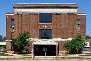
McIntosh County is a county located in the state of Oklahoma. Based on the 2010 census, the population was 20,252. Its county seat is
Eufaula. The county is named for an influential Muscogee Creek family, whose members led the migration of the Lower Towns to Indian Territory
and served as leaders for generations.
It is one of the counties within the jurisdiction of the federally recognized Muscogee (Creek) Nation.
Etymology - Origin of McIntosh County Name
Named for a family prominent in the Creek Nation, a number of the members of which were chiefs and leaders.
Demographics:
County QuickFacts: CensusBureau Quick Facts
McIntosh County History
Many archaeological sites in McIntosh County date back to the Archaic period in North America (6000 BC - 1 AD).
(Ed. note: the Encyclopedia of Oklahoma History and Culture defines this period as written here. The definition differs from that shown by the
linked Wikipedia article.) Archaeologists have uncovered six sites since 2003 that predate these. These indigenous peoples predated any of
Plains Indians, as well as the tribes that settled in the territory in the 1830s following Indian Removal from the American Southeast.
Indigenous people may have made petroglyphs at the Handprint Site before the coming of the earliest European explorers.
In 1825, the Creek of the Lower Towns in the territory of present-day Georgia, led by William McIntosh, agreed by the Treaty of Indian Springs
with the United States, to exchange their land in Georgia for land in Indian Territory. These Creek were a historic people who had originated
in the Southeast and were part of the larger Creek Confederacy for centuries. Much of their new territory was included in what later became
McIntosh County. Chief McIntosh was executed in Georgia in 1825 by order of the Creek National Council, which had forbidden such land cessions
without agreement by the full council.
His descendants and followers of the Lower Towns migrated to Indian Territory. There the Creek repeatedly battled with the Osage, who had
historically occupied a large area including this and up through present-day Missouri. In 1836, the Creek established North Fork Town on the
Texas Road, about two miles east of present-day Eufaula, Oklahoma. A post office named Micco operated in North Fork Town from 1853 to 1886.
This area became part of the Eufaula District of the Creek Nation.
Albert Pike, representing the Confederate States of America, signed treaties with the Chickasaw, Choctaw and Creek nations at the beginning of
the Civil War. They allied with the Confederacy in the hopes of gaining an Indian state after the war. The Battle of Honey Springs, the
largest battle of the war in what is now Oklahoma, was fought near Rentiesville. The Union Army won and took control of that part of Indian
Territory north of the Arkansas River.
McIntosh County was established at statehood in 1907, when the population was 17,975. Before statehood, the area had been part of the Eufaula
District of the Creek Nation. The county gained some land from Hughes County in 1915, but lost some land to Okmulgee County in 1918. The
former moved the community of Hanna from Hughes County. The latter moved the community of Stidham to Okmulgee County.
Between 1907 and 1909, the people of Checotah were involved in a dispute with nearby Eufaula known as the McIntosh County Seat War. After
Checotah was designated as the new county seat, the people of Eufaula refused to hand over the county records. Soon after, a group of heavily
armed men from Chectotah attempted to seize the records from the courthouse in Eufaula, but were beaten back and forced to surrender during
the gunfight that followed. Eufaula was designated as the permanent seat of McIntosh County one year later.
Oklahoma History Center
Located in eastern Oklahoma, McIntosh County is surrounded by Okmulgee County on the north and west, Okfuskee and
Hughes counties on the west, Muskogee County on the north and east, and Haskell and Pittsburg counties on the south.
Named for the influential Creek family of McIntoshes, the county encompasses 712.48 square miles of land and water.
Because of the convergence of three rivers, the Deep Fork, North Canadian, and Canadian, the area has a long history of
human occupation. In 1964 the US Army Corps of Engineers completed Eufaula Dam, creating Lake Eufaula. As Oklahoma's
largest-surface area lake, it dominates McIntosh County's landscape. At 1907 statehood, when the county was established,
its population stood at 17,975. The county annexed part of Hughes County in 1915 but lost land to Okmulgee County in
1918. At the beginning of the twenty-first century the county's six incorporated towns were Checotah, Eufaula (county
seat), Hanna, Hitchita, Rentiesville, and Stidham.
The county contains more than ninety-two square miles of water area, more than any other Oklahoma county, and with just
under 13 percent of its total land under water, McIntosh County is second only to Marshall County's 13.08 percent. The
creation of Lake Eufaula submerged a large amount of bottomland that had provided fertile fields. Much of the remaining
surface land comprises sandstone hills, often covered in timber....McINTOSH
COUNTY
Geography: Land and Water
As reported by the Census Bureau, the county has a total area of 712 square miles (1,840 km2), of which 618 square miles
(1,600 km2) is land and 94 square miles (240 km2) (13%) is water.
Much of the water surface is attributable to Eufaula Lake, the largest reservoir entirely within the state. Checotah is the nearest city to
Lake Checotah State Park (formerly Fountainhead State Park). The county is drained by the Deep Fork River, North Canadian River and Canadian
River
Neighboring Counties
Bordering counties are as follows:
- Muskogee County (northeast)
- Haskell County (southeast)
- Pittsburg County (south)
- Hughes County (southwest)
- Okfuskee County (west)
- Okmulgee County (northwest)
Education


Click Image to Enlarge
