


Click Image to Enlarge
Oklahoma Counties
There are seventy-seven counties in Oklahoma. Oklahoma originally had seven counties when it was first organized as the Oklahoma Territory. These counties were designated numerically, first through seventh. New counties added after this were designated by letters of the alphabet. The first seven counties were later renamed. The Oklahoma Constitutional Convention named all of the counties that were formed when Oklahoma entered statehood in 1907. Only two counties have been formed since thenMurray County, Oklahoma
Murray County Education, Geography, and History
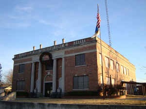
Murray County is a county located in the southern part of the state of Oklahoma. Based on the 2010 census, the population was 13,488. This is a 6.9 percent increase from 12,623 at the 2000 census. The county seat is Sulphur. The county was named for William H. Murray, a member and president of the Oklahoma Constitutional Convention and later a Governor of Oklahoma
Etymology - Origin of Murray County Name
Named for William H. Murray, president of the Constitutional Convention.
Demographics:
County QuickFacts: CensusBureau Quick Facts
Murray County History
The area now occupied by Murray County was part of the land granted to the Choctaw Nation by the Treaty of Dancing
Rabbit Creek in 1820. The Chickasaw received part of the land under the Treaty of Doaksville in 1838. The area became part of the Chickasaw
Nation in 1855. There was an extended conflict before the U. S. Civil War between the Plains Indians and the newly arrived Choctaws and
Chickasaws. The U. S. Army built Fort Towson (1824); Fort Washita (1842) and Fort Arbuckle (1851) to protect the Chickasaws. After the
conflict between the tribes was settled, various bands of outlaws moved in and continued to create law enforcement problems.
Sulphur began developing in the 1880s around the springs for which it was named. The springs encouraged the building of bathhouses and spas.
Several were established by the time that a post office was established in 1898. The Sulphur Springs Railway (acquired by the St. Louis and
San Francisco Railway in 1907) arrived there in 1902, and the 1904 establishment of Platt National Park, with headquarters at Sulphur, spurred
the expansion of services for health-seekers. Other visitors were drawn to the park and to nearby Turner Falls, making Sulphur one of the
state's earliest recreational centers.
Murray County was created when the Choctaw Nation was disestablished immediately before Oklahoma statehood. Sulphur was declared as the county
seat.
Oklahoma History Center
Murray County is located in the southeastern quarter of Oklahoma, surrounded by Garvin, Pontotoc, Johnston, and
Carter counties. Named for William H. "Alfalfa Bill" Murray, president of the 1906 Constitutional Convention, Murray
County has a total of 424.92 square miles of land and water, making it the third-smallest county in the state. The
county's northern section lies in the Sandstone Hills physiographic region and is suitable for farming, while the
southern portion is in the Arbuckle Mountains region, which is dominated by rolling hills and rock outcrops. The Washita
River drains the county and is fed by Falls and Rock creeks, among others. Lake of the Arbuckles was completed on Rock
Creek in 1966....MURRAY
COUNTY
Geography: Land and Water
As reported by the Census Bureau, the county has a total area of 425 square miles (1,100 km2), of which 416 square miles
(1,080 km2) is land and 8.6 square miles (22 km2) (2.0%) is water. It is the third-smallest county in Oklahoma by land area and
second-smallest by total area.
The county's northern section lies in the Sandstone Hills physiographic region and is suitable for farming, while the southern portion is in
the Arbuckle Mountains region, which is dominated by rolling hills and rock outcrops. The Washita River drains the county. Chickasaw National
Recreation Area (CNRA) lies in the county. Lake of the Arbuckles, part of CNRA, was completed on Rock Creek in 1966.
Neighboring Counties
Bordering counties are as follows:
- Pontotoc County (northeast)
- Johnston County (southeast)
- Carter County (southwest)
- Garvin County (northwest)
Education


Click Image to Enlarge
