


Click Image to Enlarge
Oklahoma Counties
There are seventy-seven counties in Oklahoma. Oklahoma originally had seven counties when it was first organized as the Oklahoma Territory. These counties were designated numerically, first through seventh. New counties added after this were designated by letters of the alphabet. The first seven counties were later renamed. The Oklahoma Constitutional Convention named all of the counties that were formed when Oklahoma entered statehood in 1907. Only two counties have been formed since thenOkfuskee County, Oklahoma
Okfuskee County Education, Geography, and History
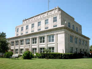
Okfuskee County is a county located in the state of Oklahoma. Based on the 2010 census, the population was 12,191. Its county seat is Okemah. The county is named for a former Muscogee town in present Cleburne County, Alabama, that in turn was named for the Okfuskee, a Muscogee tribe.
Etymology - Origin of Okfuskee County Name
Named for one of the Creek Indian towns or clans.
Demographics:
County QuickFacts: CensusBureau Quick Facts
Okfuskee County History
The area now covered by Okfuskee County was occupied by the Quapaw and Osage tribes until 1825, when they ceded the
land to the United States government. The Creeks moved here in the early 1830s and built two towns, Greenleaf and Thlopthlocco. During the Civil
War, Thlopthlocco served as headquarters for Confederate Col. Douglas H. Cooper. Greenleaf was the place where Chief Opothleyahola camped while he
tried to retain unity among the Creeks, before leading over five thousand Creeks to Kansas to avoid the war.
After the war, the Creeks were required to free their African American slaves. Many of these people remained in the same area and founded all-black
communities. These towns included Boley, Bookertee, Clearview, Chilesville, and Rusk. Okfuskee, a Creek town, grew up around Samuel Checote's
trading post after the Civil War.
The St. Louis and San Francisco Railway built a north-south line through this area during 1901-03. The Fort Smith and Western Railroad constructed
an east-west line in 1903.
Okfuskee County was created at statehood from the former Creek Nation, and Okemah was designated as the county seat. Oil and gas production began in
the county in 1914, when the Prairie Oil and Gas Company completed a well near Paden. Other wells followed elsewhere in the county, creating a
population boom that peaked in 1930.
Oklahoma History Center
Located in east-central Oklahoma, Okfuskee County is bordered by Creek County on the north, Okmulgee and McIntosh
counties on the east, Hughes and Seminole counties on the south, and Lincoln and Pottawatomie counties on the west.
Organized at 1907 statehood, the county is named for a former Creek town in present Cleburne County, Alabama. At the
turn of the twenty-first century incorporated towns included Bearden, Boley, Castle, Clearview, Paden, Weleetka, and
Okemah, the county seat. Formerly part of the Creek Nation, Indian Territory, Okfuskee County has 628.91 acres of land
and water. Lying within the Sandstone Hills physiographic region, the county is drained by the Deep Fork of the Canadian
River in the northeastern corner and by the North Canadian River, which forms its southern boundary with Seminole
County. Okfuskee County lies within a region that has been little studied by archaeologists. However, a 1983 published
archaeological survey reported forty known sites, of which one has been tested....OKFUSKEE
COUNTY
Geography: Land and Water
As reported by the Census Bureau, the county has a total area of 629 square miles (1,630 km2), of which 619 square miles (1,600 km2) is land and 10 square miles (26 km2) (1.6%) is water. The county lies within the Sandstone Hills physiographic region. The northerneastern part is drained by the Deep Fork of the Canadian River, while the southern part is drained by the North Canadian River.
Neighboring Counties
Bordering counties are as follows:
- Creek County (north)
- Okmulgee County (east)
- McIntosh County (southeast)
- Hughes County (south)
- Seminole County (southwest)
- Pottawatomie County (southwest)
- Lincoln County (west)
Education


Click Image to Enlarge
