


Click Image to Enlarge
Oklahoma Counties
There are seventy-seven counties in Oklahoma. Oklahoma originally had seven counties when it was first organized as the Oklahoma Territory. These counties were designated numerically, first through seventh. New counties added after this were designated by letters of the alphabet. The first seven counties were later renamed. The Oklahoma Constitutional Convention named all of the counties that were formed when Oklahoma entered statehood in 1907. Only two counties have been formed since thenPawnee County, Oklahoma
Pawnee County Education, Geography, and History
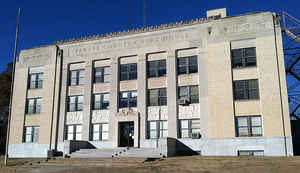
Pawnee County is a county located in the state of Oklahoma. Based on the 2010 census, the population was 16,577. Its county seat is Pawnee.
The county is named after the Pawnee Tribe.
Pawnee County is included in the Tulsa, OK Metropolitan Statistical Area.
Etymology - Origin of Pawnee County Name
the tribal name corrupted from "Pariki," meaning horn and refers to the tribal custom of dressing the scalp locks to resemble a buffalo horn
Demographics:
County QuickFacts: CensusBureau Quick Facts
Pawnee County History
The Osage Tribe used the area that contains present day Pawnee County as buffalo hunting grounds. In 1825, The Osage
ceded parts of present-day Missouri, Arkansas and most of the future state of Oklahoma to the federal government.
After their forced removal from the Southeastern United States, the Cherokee received land in Eastern Oklahoma as well as the Cherokee Outlet
in 1828, which included present-day Pawnee County. After the Civil War, the Cherokee agreed to allow other American Indians to settle in the
eastern portion of the Outlet. In 1873, the federal government began to relocate the Pawnee Tribe from Nebraska to a reservation here.
In 1891, the Pawnee agreed to take land allotments from the reservation, and the remaining land was opened to non-Indian settlers in 1893
during the Cherokee Outlet opening. Pawnee County was organized as County Q, and the future town of Pawnee, Townsite Number 13, was designated
the county seat. In 1894, the voters chose the name Pawnee County over the name Platte County.
Oklahoma History Center
Located in north-central Oklahoma, Pawnee County is bordered on the north and east by Osage County and the Arkansas
River, on the south by Creek and Payne counties, and on the west by Noble and Payne counties. Organized as Q County
following the Cherokee Outlet land opening on September 16, 1893, it was renamed Pawnee County in 1894 for the Pawnee
tribe. The western one-third of the county lies in the Red Bed Plains physiographic region, and the Sandstone Hills
region comprises the remaining two-thirds. With 594.87 square miles of land and water, the county is drained by the
Cimarron and Arkansas rivers as well as tributaries such as Black Bear Creek. At the turn of the twenty-first century
incorporated towns included Blackburn, Cleveland, Hallett, Jennings, Maramec, Pawnee (county seat), Quay, Ralston, Shady
Grove, Skedee, Terlton, and Westport....PAWNEE
COUNTY
Geography: Land and Water
As reported by the Census Bureau, the county has a total area of 595 square miles (1,540 km2), of which 568 square miles
(1,470 km2) is land and 27 square miles (70 km2) (4.5%) is water.
The western third of the county is part of the Red Bed plains,while the remainder is in the Sandstone Hills region. The Cimarron and Arkansas
Rivers drain the county. Black Bear Creek also extends through the county. Lone Chimney Lake dam is also in Pawnee County, while the lake
extends into Payne County.
Neighboring Counties
Bordering counties are as follows:
- Osage County (northeast)
- Tulsa County (southeast)
- Creek County (south)
- Payne County (southwest)
- Noble County (west)
Education


Click Image to Enlarge
