


Click Image to Enlarge
Oklahoma Counties
There are seventy-seven counties in Oklahoma. Oklahoma originally had seven counties when it was first organized as the Oklahoma Territory. These counties were designated numerically, first through seventh. New counties added after this were designated by letters of the alphabet. The first seven counties were later renamed. The Oklahoma Constitutional Convention named all of the counties that were formed when Oklahoma entered statehood in 1907. Only two counties have been formed since thenPittsburg County, Oklahoma
Pittsburg County Education, Geography, and History
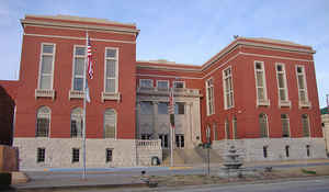
Pittsburg County is a county located in the state of Oklahoma. Based on the 2010 census, the population was 45,837. Its county seat is
McAlester. The county was formed from part of the Choctaw Nation in Indian Territory in 1907. County leaders believed that its coal production
compared favorably with Pittsburgh, Pennsylvania at the time of statehood.
Pittsburg County comprises the McAlester, OK Micropolitan Statistical Area.
Etymology - Origin of Pittsburg County Name
Named for the city of Pittsburgh, Pennsylvania, the final "h" having been dropped.
Demographics:
County QuickFacts: CensusBureau Quick Facts
Pittsburg County History
The area forms the present Pittsburg county was part of the Choctaw Nation after the Choctaw tribe was forced to
relocate to Indian Territory from its home in the Southeastern United States in the early 1830s. Some important trails, including the Texas
Road and one route of the California Trail passed through it. In 1840, James Perry established a village called Perryville that became an
important stop near the place where the two trails crossed. During the Civil War, Perryville served as an important supply depot for
Confederate forces until the Union Army captured and burned the town. It became defunct after the Missouri, Kansas and Texas Railway (MK&T)
bypassed it in 1872, and the remaining inhabitants moved to McAlester. The Butterfield Overland Mail route followed a route through this area.
James J. McAlester moved to the Choctaw Nation in 1872, opened a trading post and married a Chickasaw woman. This qualified him to obtain
citizenship rights in the Choctaw and Chickasaw Nations. When the MK&T built its line, McAlester laid claim to the coal deposits in the
Perryville area, which he and some partners leased to the Osage Coal and Mining Company, which was owned by the Missouri Pacific Railroad and
acquired by the MK&T in 1888.
Pittsburg County was formed on July 16, 1907 as an original county from Choctaw land. County leaders, thinking its coal production compared
favorably with Pittsburgh, Pennsylvania, was named the new county after the Pennsylvania city with the "h" removed.
Oklahoma History Center
Located in east-central Oklahoma, Pittsburg County, created at 1907 statehood, incorporates 1,377.85 square miles of
land and water. Because of the county's early coal production, leaders suggested the name Pittsburg, referring to
Pittsburgh, Pennsylvania, comparing the county's large coal quantity to the northern state. The county borders McIntosh
County on the north, Haskell and Latimer on the east, Atoka and Pushmataha to the south, and Hughes and Coal counties on
the west. At the turn of the twenty-first century Pittsburg County's incorporated towns included Alderson, Ashland,
Canadian, Crowder, Haileyville, Hartshorne, Indianola, Kiowa, Krebs, McAlester (county seat), Pittsburg, Quinton, and
Savanna.
Pittsburg County is generally hilly and in places mountainous. The Ouachita Mountains extend into the southeastern
portion, with sandstone hills contributing to most of the landscape in the northern and western sections. The Canadian
River and Lake Eufaula form the northern boundary and drains most of Pittsburg County. A few creeks and streams,
including Jack Fork Creek, drain into Boggy Creek and the Kiamichi River and eventually into the Red River....PITTSBURG
COUNTY
Geography: Land and Water
As reported by the Census Bureau, the county has a total area of 1,378 square miles (3,570 km2), of which 1,305 square miles
(3,380 km2) is land and 72 square miles (190 km2) (5.3%) is water.
The county's topography is generally hilly to mountainous. The Ouachita Mountains extend into the southeastern portion. The Canadian River
drains most of the county and with Eufaula Lake form the northern boundary of the county. The southern part of the county is drained by
several creeks that flow into the Kiamichi River and then into the Red River.
Neighboring Counties
Bordering counties are as follows:
- McIntosh County (north)
- Haskell County (northeast)
- Latimer County (east)
- Pushmataha County (southeast)
- Atoka County (south)
- Coal County (southwest)
- Hughes County (west)
Education


Click Image to Enlarge
