Oklahoma Counties
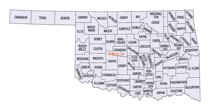
There are seventy-seven counties in Oklahoma. Oklahoma originally had seven counties when it was first organized as the Oklahoma Territory. These counties were designated numerically, first through seventh. New counties added after this were designated by letters of the alphabet. The first seven counties were later renamed. The Oklahoma Constitutional Convention named all of the counties that were formed when Oklahoma entered statehood in 1907. Only two counties have been formed since thenRogers County, Oklahoma
Rogers County Education, Geography, and History

Rogers County is a county located in the northeastern part of the state of Oklahoma. Based on the 2010 census, the population was 86,905.
Its county seat is Claremore, making it the sixth largest county in Oklahoma based on population. The county was originally created in 1907
from the western Saline District of the Cherokee Nation and named the Cooweescoowee District. However, the residents protested and the name
was changed to Rogers County, after Clem Vann Rogers, a mixed-blood Cherokee rancher and father of Will Rogers.
Rogers County is included in the Tulsa, OK Metropolitan Statistical Area.
Etymology - Origin of Rogers County Name
Named for Clement V. Rogers, member of the Constitutional Convention and father of Will Rogers, the stage comedian.
Demographics:
County QuickFacts: CensusBureau Quick Facts
Rogers County History
According to the Encyclopedia of Oklahoma History and Culture, the Arkansas Band of the Osage Nation settled in the
Three Forks area (the junction of the Arkansas River, Grand River and Verdigris River during the 1760s and established two villages called
Pasuga and Pasona in what is now Rogers County. Pasona was near a mound on the Verdigris River called Claremore Mound. The name honored Chief
Claremore (Gra-mon or Arrow Going Home).
In 1828, Cherokee tribes exchanged their Arkansas land for an area that included present-day Rogers County that had been ceded by the Osage in
1825. The area became the Saline District of the Cherokee Nation in Indian Territory and later the Cooweescoowee District
Upon statehood, the county was created and designated Cooweescoowee County before being renamed Rogers County in honor of Clement Rogers.
Oklahoma History Center
Rogers County is located on the Eastern Lowlands of northeastern Oklahoma. It is bordered by Nowata County to the
north, Craig County to the northeast, Mayes County to the east, Wagoner County to the south, Tulsa County to the
southwest, and Washington County to the northwest. Rogers County contains 711.44 square miles of land and water area.
The terrain is relatively level, but dotted with small hills. Its incorporated communities are Catoosa, Chelsea,
Claremore (the county seat), Foyil, Inola, Jamestown, Oologah, Talala, and Valley Park....ROGERS
COUNTY
Geography: Land and Water
As reported by the Census Bureau, the county has a total area of 711 square miles (1,840 km2), of which 676 square miles (1,750 km2) is land and 36 square miles (93 km2) (5.0%) is water. The largest body of water is Lake Oologah. The main streams are the Caney River and the Verdigris River. However, there are a number of smaller creeks and lakes in the county
Neighboring Counties
Bordering counties are as follows:
- Nowata County (north)
- Craig County (northeast)
- Mayes County (east)
- Wagoner County (south)
- Tulsa County (southwest)
- Washington County (northwest)
Education


