Oklahoma Counties
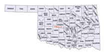
There are seventy-seven counties in Oklahoma. Oklahoma originally had seven counties when it was first organized as the Oklahoma Territory. These counties were designated numerically, first through seventh. New counties added after this were designated by letters of the alphabet. The first seven counties were later renamed. The Oklahoma Constitutional Convention named all of the counties that were formed when Oklahoma entered statehood in 1907. Only two counties have been formed since thenSeminole County, Oklahoma
Seminole County Education, Geography, and History

Seminole County is a county located in the state of Oklahoma. Based on the 2010 census, the population was 25,482. Its county seat is Wewoka. Before Oklahoma's admission as a state, the county was the entire small portion of Indian Territory allocated to the Seminole people, who were removed from Florida in the 1820s.
Etymology - Origin of Seminole County Name
Named for the Indian tribe, the name being a corruption of "Seminola," a Creek Indian word for "seceder" or "runaway," the Seminole tribe having originally been an offshoot of the Creek tribe.
Demographics:
County QuickFacts: CensusBureau Quick Facts
Seminole County History
Seminole County has been an important part of the Oklahoma and United States petroleum industry for over 80 years.
The Greater Seminole Field was one of the most important oil fields ever found and is still producing. Discovered one field after another in
1926, it contained an estimated 822,000,000 barrels (130,700,000 m3) of oil. To group the fields together, the oil companies decided to come
up with a name, and this was suggested by Paul Hedrick, oil editor of the Tulsa World. Other important oil fields in the area were the
Cromwell oil field, discovered in 1923, and the Maud oil field. The Maud field, discovered in 1927 by Amerada Petroleum, was the first
discovery using reflection seismology. This marked the beginning of the use of modern geophysical methods in the petroleum industry.
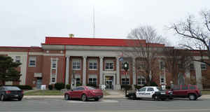
The Seminole County Courthouse was built in 1927.
Oklahoma History Center
Located approximately fifty miles east of Oklahoma City along Interstate 40, Seminole County extends from the North
Canadian River south to the Canadian River. The county is bordered by Pottawatomie County to the north and west,
Pontotoc County to the south, Hughes County to the east, and Okfuskee to the east and north. Seminole County encompasses
640.57 square miles of total land and water area in the Sandstone Hills region of east-central Oklahoma. At the turn of
the twenty-first century incorporated towns included Bowlegs, Cromwell, Konawa, Lima, Sasakwa, Wewoka, and Seminole, the
county seat....SEMINOLE
COUNTY
Geography: Land and Water
As reported by the Census Bureau, the county has a total area of 640 square miles (1,700 km2), of which 633 square miles (1,640 km2) is land and 7.6 square miles (20 km2) (1.2%) is water. The county is bounded on the north by the North Canadian River and on the south by the Canadian River
Neighboring Counties
Bordering counties are as follows:
- Okfuskee County (northeast)
- Hughes County (east)
- Pontotoc County (south)
- Pottawatomie County (west)
Education


