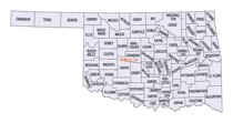
Oklahoma Counties
There are seventy-seven counties in Oklahoma. Oklahoma originally had seven counties when it was first organized as the Oklahoma Territory. These counties were designated numerically, first through seventh. New counties added after this were designated by letters of the alphabet. The first seven counties were later renamed. The Oklahoma Constitutional Convention named all of the counties that were formed when Oklahoma entered statehood in 1907. Only two counties have been formed since thenTexas County, Oklahoma
Texas County Education, Geography, and History

Texas County is a county located in the panhandle of the state of Oklahoma. Its county seat is Guymon. Based on the 2010 census, the
population was 20,640. It is the second-largest county in the state, based on land area, and is named for Texas, the state that adjoins the
county to its south.
Texas County comprises the Guymon, OK Micropolitan Statistical Area.
Etymology - Origin of Texas County Name
Named because the No-Mans-Land or Panhandle strip of which it was a part, formed a part of the Texas session of 1850.
Demographics:
County QuickFacts: CensusBureau Quick Facts
Texas County History
Texas County was formed at Oklahoma statehood (16 November 1907) from the central one-third of "Old Beaver County". When the formation of the county was authorized by the Constitutional Convention of 1907, the county was so named because it was wholly included within the limits of the Texas Cession of 1850, whereby the ownership of the area was passed from the State of Texas to the United States Government. From 1850 to 1890, its lands were never attached to any state or territory, never surveyed, and never divided into townships and sections like the eastern counties were. From 1890 to 1907, it was part of Beaver County
Oklahoma History Center
One of three Oklahoma Panhandle counties created at 1907 statehood from Beaver County (formerly the Public Land
Strip), Texas County is the state's second largest, encompassing 2,048.82 square miles of land and water area. It is
bounded by Cimarron County on the west, by Beaver on the east, and by the states of Kansas and Texas on the north and
south, respectively. In the late 1880s the area was also included in the proposed Cimarron Territory.
Since 1907 Guymon has been the seat of county government. In addition to Guymon, incorporated towns include Goodwell,
Hardesty, Hooker, Optima, Texhoma, and Tyrone.
The county's topography, in the High Plains of the Great Plains physiographic region, is generally flat, with some
rolling hills. The original vegetation comprised various short grasses, mostly bluestem and gramma. Arable sections are
now farmlands, and the remainder generally serves as rangeland for grazing. Numerous playa lakes occur, intermittently
holding water. These include, north of Guymon, Wild Horse Lake, the scene of the Hay Meadow Massacre, an infamous,
four-victim murder of a Kansas posse in the 1880s. The county is drained by the North Canadian River, often called the
Beaver River, and its tributaries, including Coldwater, Hackberry, Goff, Teepee, and Pony creeks. Along these waterways,
the region's few trees, including cottonwood, hackberry, willow, and elm, occur...TEXAS
COUNTY
Geography: Land and Water
As reported by the Census Bureau, the county has a total area of 2,049 square miles (5,310 km2), of which 2,041 square miles
(5,290 km2) is land and 7.4 square miles (19 km2) (0.4%) is water. It is the second-largest county in Oklahoma by area. The county lies in the
High Plains of the Great Plains physiographic region. It is generally flat, but has some rolling hills. It is drained by the North Canadian
River, often called the Beaver River in this area. Tributaries of the river are Coldwater, Hackberry, Goff, Teepee, and Pony creeks.
Optima Lake, created in 1978 by damming the Beaver River and Coldwater Creek, is 2 miles (3.2 km) north of Hardesty.
Neighboring Counties
Bordering counties are as follows:
- Stevens County, Kansas (north)
- Seward County, Kansas (northeast)
- Beaver County (east)
- Ochiltree County, Texas (southeast)
- Hansford County, Texas (south)
- Sherman County, Texas (southwest)
- Cimarron County (west)
- Morton County, Kansas (northwest)
Texas County is one of four counties in the United States to border the state with which it shares its name (the other three are Nevada County, California, Delaware County, Pennsylvania, and Ohio County, West Virginia).
Education
The Oklahoma Legislature created the Pan-Handle Agricultural Institute in 1909, offering secondary agricultural education for the Panhandle area. In 1921, the legislature changed the name to Panhandle Agricultural and Mechanical College and authorized the school to offer a two-year curriculum. In 1925, the State Board of Agriculture authorized upper division college courses, and in 1926, junior and senior level courses were added. The school name has been changed twice since then, to Oklahoma Panhandle State College of Agriculture and Applied Science (OPSU) in 1967 and to Oklahoma Panhandle State University in 1974. The school is in Goodwell.


