


Click Image to Enlarge
Oklahoma Counties
There are seventy-seven counties in Oklahoma. Oklahoma originally had seven counties when it was first organized as the Oklahoma Territory. These counties were designated numerically, first through seventh. New counties added after this were designated by letters of the alphabet. The first seven counties were later renamed. The Oklahoma Constitutional Convention named all of the counties that were formed when Oklahoma entered statehood in 1907. Only two counties have been formed since thenWoodward County, Oklahoma
Woodward County Education, Geography, and History
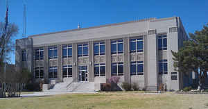
Woodward County is a county located in the state of Oklahoma. Based on the 2010 census, the population was 20,081. Its county seat is Woodward. Woodward County was originally known as "N" County and was composed of present-day Woodward County and portions of Harper, Ellis, and Woods County. Before its division at statehood, Woodward County, then 60 miles square, was the westernmost county of the Cherokee Outlet and adjoined Texas and the Oklahoma Panhandle on the west and Kansas on the north. Political pressure applied by William H. Murray during Oklahoma's Constitutional Convention resulted in the reduction of the size of Woodward County to its present boundaries.
Woodward County comprises the Woodward, OK Micropolitan Statistical Area.
Etymology - Origin of Woodward County Name
It is unknown exactly whom the county (and the town) is named after, but the two leading candidates are Brinton W. Woodward, a Santa Fe railway director,or Richard Woodward, a buffalo hunter.
Demographics:
County QuickFacts: CensusBureau Quick Facts
Woodward County History
In the 19th century, the county was part of a well-used military transportation corridor that was important to frontier defense. In 1868,
Camp Supply, was established as a depot leading up to a campaign against the Cheyenne. From 1876 through the 1880s massive herds of cattle
passed through the southwestern corner of the county along the Great Western Trail from Texas to Kansas.
The Southern Kansas Railway, later acquired by the Atchison, Topeka and Santa Fe Railway built a line southwest from Kiowa, Kansas, through
the region and into Texas during 1886-1887. It began the town of Woodward where the railroad crossed the military road. The Wichita Falls and
Northwestern Railway, controlled by the Missouri, Kansas and Texas Railway, constructed a north-south line from Elk City through Sharon,
Woodward, and the town of Fort Supply to Forgan, in Beaver County, in 1911-12.
In September 1893, when the Cherokee Outlet opened for non-Indian settlement, Woodward County was created as County N in Oklahoma Territory,
though its area was much larger than at present. In a November 6, 1894, election, the county was renamed Woodward County. Statehood in 1907
redrew the boundaries of the county, while the remainder was given to the present Harper, Ellis and Woods counties
Oklahoma History Center
Located in northwestern Oklahoma, Woodward County encompassed 1246.01 square miles of land and water area in the year
2000. Bordering counties include Harper and Ellis counties on the west, Dewey on the south, Woods on the north, and
Major on the west. Woodward County is part of the Osage Plains, within the Western Red Prairies physiographic region and
Gypsum Hills subregion, and its western side is technically within the Great Plains proper. Historically, the
environment was one of rolling plains, grassy prairies, and in places, gypsum hills. The land is drained by three
waterway systems. The Cimarron River, which forms part of the county's boundary with Woods County, collects the
groundwater of the northwestern section. The North Canadian bisects the county from northwest to southeast. A
northward-flowing tributary of the North Canadian, Wolf Creek, is dammed south of Fort Supply to form Fort Supply Lake.
Creeks in the southern part of the county drain into the main (South) Canadian. The eastern and northwestern portions of
the county have gypsum hills. Extending from Harper through Woods and Woodward counties is the five-thousand-acre Big
Salt Plain. An extremely large gypsum cave, located eighteen miles north of Mooreland, forms a significant geologic
feature and is protected as part of Alabaster Caverns State Park. Boiling Springs State Park, west of Woodward,
comprises 820 acres surrounding natural springs....WOODWARD
COUNTY
Geography: Land and Water
As reported by the Census Bureau, the county has a total area of 1,246 square miles (3,230 km2), of which 1,242 square miles
(3,220 km2) is land and 3.7 square miles (9.6 km2) (0.3%) is water. The Cimarron River forms part of the northern boundary and drains the
northwestern section of the county. The North Canadian River flows through the county from the northwest to the southeast. The southern part
of the county drains into the Canadian River. Fort Supply Lake, on Wolf Creek, lies in Woodward County.
The county is part of the Osage Plains and lies within the Western Red Prairies physiographic region and Gypsum Hills subregion. There are
gypsum hills in the eastern and northwestern parts of the county. Protected areas in the county are Alabaster Caverns State Park and Boiling
Springs State Park
Neighboring Counties
Bordering counties are as follows:
- Dewey County (south)
- Ellis County (west)
- Harper County (northwest)
- Major County (east)
- Woods County (northeast)
Education


Click Image to Enlarge
