


Click Image to Enlarge
Wisconsin Counties
There are seventy-two counties in the state of Wisconsin. Wisconsin became part of the Territory of Michigan and divided into two counties: Brown County in the northeast along Lake Michigan and Crawford County in the southwest along the Mississippi River. The state of Wisconsin was created from Wisconsin Territory on May 29, 1848, with 28 counties.Chippewa County, Wisconsin
Chippewa County Education, Geography, and History
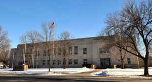
Chippewa County is a county located in the state of Wisconsin. Based on the 2010 census, the population was 62,415. Its county seat is
Chippewa Falls. The county was founded in 1845 from Crawford County, then in the Wisconsin Territory, and organized in 1853.
Chippewa County is included in the Eau Claire, WI Metropolitan Statistical Area as well as the Eau Claire-Menomonie, WI Combined
Statistical Area.
Etymology - Origin of Chippewa County Name
Chippewa County was named from its principal river, which was given this Indian tribal designation by
French voyageurs. The first name applied by the early explorers to this stream was Bon Secours; it likewise occasionally
appears on early maps as Bacqueville, possibly in honor of Bacqueville de la Potherie, the Canadian historian. About the
middle of the eighteenth century the Chippewa tribesmen began to settle in this region, and founded villages on the
headwaters of the stream - Minn. Hist. Colls., v.
Thereafter the river began to be called from the French form of their name, Riviere des Sauteurs. Jonathan Carver
applies the term Chippewa to the stream which he ascended in 1766, and appended this name to the map that appeared in
the edition of his Travels published in 1778. From thence until the time of American occupation, the river was known by
either term - des Sauteurs or Chippewa. For the significance of this tribal name, see Gannett, Place Names, p. 72;-.
Handbook, p. 277.
Demographics:
County QuickFacts: CensusBureau Quick Facts
Chippewa County History
John W. Hunt's 1853 Wisconsin Gazetteer
"CHIPPEWA , County, is bounded on the N. by St. Croix and La Pointe, on the E. by Marathon, on the S. by La Crosse, on the S. W. by the Mississippi river, and on the W. by St. Croix. The southern boundary is rather indefinitely defined. Population in 1850 was 615. The soil in the western portion is good, in the northeastern less valuable, and covered with forests of excellent pine timber. It is watered by Chippewa river and its branches, and tributaries of Buffalo and Mississippi rivers. The tributaries of the Chippewa river are numerous, and pass through large portions of the county, watering lands as valuable as any in the State. There are now in successful operation 11 saw mills, capable of cutting 30,000,000 feet of lumber annually. The largest of these mills is owned by Allen, at Chippewa Falls; Menomonee, owned by Knapp, Williams & Taintor; and Carson & Eaton, at the mouth of the Eau Galla, which average about 5,000,000 of feet each, per annum, and furnish employment for about 200 hands each. The county seat was established by an act of the legislature, at the January session 1853, at Chippewa Falls, on Chippewa river."
[Source: Kellogg, Louise Phelps. "Derivation of County Names" in Proceedings of the State Historical Society of Wisconsin for 1909, pages 219-231.]
CHIPPEWA.
From: Handbook of Wisconsin by S. Silas, 1855
pg. 52-54
One of the largest counties of the State, extending from the line between towns 24 and 25 north, to the line between 40 and 41, being 91 miles long, and averaging about 66 broad. Not one-half of the County is yet surveyed and brought into market. The County is watered by the Chippewa and Yellow Rivers, and their numerous branches, both large and small. It is, in its full sense, a well watered County. Our further description will apply only to the surveyed or Southern part of the County, which will undoubtedly soon be subdivided into several Smaller Counties.
The soil in the western part of the County is good, and great progress has been made in settlements for agricultural
purposes. In the northeastern part, the soil is less valuable for farming purposes, but rich soil for the lumbering
business, as it is covered with excellent pine.
Chippewa county contains one of the best and most extensive pineries in the State. There are now in successful
operation twelve saw mills on the Chippewa River, capable of cutting 40,000,000 feet of lumber annually. The largest
of these mills is located at Chippewa Falls and is commonly known as Allen's Mills; Menomonee, Mills; and at the
month of the Eau Galla, is Carson and Eaton's. These mills average about 6,000,000 feet annually, and furnish
employment for about 600 men.
The most of the land in the county is still subject to entry. It affords inducements to the immigrant both
agricultural and mechanical, as the resources of the county are such as to give permanency to business, and a sure
market is always to be found for the products of the forest.
Chippewa Falls, on Chippewa River, is the County seat. It is the principal depot of the lumbering operations on that
River, the pines being above this village. Messrs. H. S. Allen & Co. have an extensive sawmill at these falls,
sawing daily about 60,000 feet, and giving employment to about 400 men in the business connected with it. A road
from Steven's Point to Hudson, passing this place, is soon to be opened.
We are indebted for most to the Hudson Journal, whose assistance we have occasion to acknowledge in another part of
this work. Did the papers of other localities take the same pains to give local information as this, the Pinery at
Steven's Point, and the Crescent at Appleton, we should possess much more sure and valuable information respecting
the resources of our State. Such journals are worth more than the whole cost of publications to the different
countries where they are located, and we do not doubt but they have been the direct means of doubting the
population, and developing the resources in a corresponding ratio of the counties where they are respectively
located.
Geography: Land and Water
As reported by the Census Bureau, the county has a total area of 397 square miles (1,028 km2), of which, 320 square miles (828 km2) of it is land and 77 square miles (200 km2) of it (19.44%) is water. The west boundary is largely in Lake Winnebago. The Niagara Escarpment runs north-south several miles east of the western boundary. The land surface topology has been greatly influenced by glaciation.
Neighboring Counties
Bordering counties are as follows:
- Rusk County - north
- Taylor County - east
- Clark County - southeast
- Eau Claire County - south
- Dunn County - west
- Barron County - northwest
Education


Click Image to Enlarge
