


Click Image to Enlarge
Wisconsin Counties
There are seventy-two counties in the state of Wisconsin. Wisconsin became part of the Territory of Michigan and divided into two counties: Brown County in the northeast along Lake Michigan and Crawford County in the southwest along the Mississippi River. The state of Wisconsin was created from Wisconsin Territory on May 29, 1848, with 28 counties.Dodge County, Wisconsin
Dodge County Education, Geography, and History
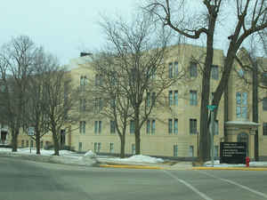
Dodge County is a county located in the state of Wisconsin. Based on the 2010 census, the population was 88,759. Its county seat is Juneau.
The county was created from the Wisconsin Territory in 1836 and organized in 1844.
Dodge County comprises the Beaver Dam, WI Micropolitan Statistical Area, which is included in the Milwaukee-Racine-Waukesha, WI Combined
Statistical Area
Etymology - Origin of Dodge County Name
Dodge County was named for Henry Dodge, first Territorial governor of Wisconsin (q.v.).
[Source: Kellogg, Louise Phelps. "Derivation of County Names" in Proceedings of the State Historical Society of Wisconsin for 1909, pages 219-231.]
Demographics:
County QuickFacts: CensusBureau Quick Facts
Dodge County History
John W. Hunt's 1853 Wisconsin Gazetteer
"DODGE, County, is bounded on the north by Marquette and Fond du Lac, on the east by Fond du Lac and Washington, on the south by Waukesha and Jefferson, and on the west by Dane and Columbia; and is 30 miles square. It was so named in honor of General [Henry] Dodge, first Governor of the territory, and was set off from Brown, December 7, 1836... It was fully organized Jan, 20, 1844. The seat of justice is at the village of Juneau, formerly known as Dodge Centre. The surface of the country, west of Rock river, is diversified with openings, prairie, and good hay marsh; and the soil being good, it is well adapted to the raising of wheat and the summer grains, and to grazing. East of the river it is timbered with a heavy growth of maple and other hard woods, and the soil produces the grain crop with equal advantage with the other side, while it is more naturally adapted to the growth of the cultivated grasses. Near the banks of Rock river are beds of iron ore, which are success fully worked. It is watered by the Crawfish, Rock and Beaver Dam rivers, and their tributaries. The population in 1838 was 18; 1840, 67; 1842, 149; 1846, 7,787; 1847,14,905; and 1850, 19,140. Dwellings, 3,561; farms, 2,338; manufactories, 30."
DODGE--Population 34, 054.
From: Handbook of Wisconsin by S. Silas, 1855
pg. 61-62
A beautiful, rich, and healthy County. It is one of the best for agricultural purposes, well watered, diversified
in surface, being prairie, openings, and a moderate amount of timber, and is of easy access to market. It has
sufficient water power for ordinary purposes. The La Crosse and Milwaukee Rail Road passes through it nearly east
and west. This will be completed to Horicon in November, and to Beaver Dam early in the winter.
The Milwaukee and Horicon Road leaves the track of the La Crosse at Horicon, running north to Berlin on the Fox. It
will be in running order to Waupun early in the winter, and in connection with that part of the Valley Road from
Waupun to Fond du Lac, will give the latter place a Rail Road connection with the lake shore.
The immense deposit of iron ore at Iron Ridge is one of the most remarkable in the north west. It lies within a mile
of the La Crosse Rail Road, and five miles from Horicon. A furnace has already been erected at Mayville, which is
manufacturing it extensively into pig iron, and there is little doubt that bar iron of the first quality can be
manufactured directly from the ore.
The village of Junean in the town of Fairfield is the county seat.
Beaver Dam, at the outlet of Beaver Dam lake, is the largest place, containing a population in village and town of
3,000. Its growth at present is more rapid that at any former period. Horicon and Fox Lake are both of vigorous
growth. Two wards of the city of Watertown are in Dodge County--the other three in Jefferson.
Geography: Land and Water
As reported by the Census Bureau, the county has a total area of 907 square miles (2,349 km2), of which, 882 square miles (2,285 km2) of it is land and 25 square miles (64 km2) of it (2.72%) is water.
Neighboring Counties
Bordering counties are as follows:
- Fond du Lac County - northeast
- Washington County - east
- Waukesha County - southeast
- Jefferson County - south
- Dane County - southwest
- Columbia County - west
- Green Lake County - northwest
Education


Click Image to Enlarge
