


Click Image to Enlarge
Wisconsin Counties
There are seventy-two counties in the state of Wisconsin. Wisconsin became part of the Territory of Michigan and divided into two counties: Brown County in the northeast along Lake Michigan and Crawford County in the southwest along the Mississippi River. The state of Wisconsin was created from Wisconsin Territory on May 29, 1848, with 28 counties.Dunn County, Wisconsin
Dunn County Education, Geography, and History
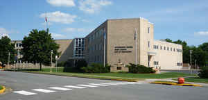
Dunn County is a county in the state of Wisconsin. Based on the 2010 census, the population was 43,857. Its county seat is Menomonie.
Dunn County comprises the Menomonie, WI Micropolitan Statistical Area and is included in the Eau Claire-Menomonie, WI Combined Statistical
Area.
Etymology - Origin of Dunn County Name
Dunn County was named in honor of Charles Dunn, first chief justice of Wisconsin Territory - Gannett,
Place Names, p. 98.
Charles Dunn (1799-1872) was born in Kentucky, where he studied law, but was admitted to the bar (1820) in Illinois.
During his residence in that state he served as captain in the Black Hawk War, wherein he was accidentally shot by a
sentinel. In 1829 he assisted in laying out the plat of Chicago. Appointed chief justice of Wisconsin Territory in 1836,
he served throughout the Territorial era, also acting as member of the second State constitutional convention. In
1852-53 he was State senator from Lafayette County, and died at his home at Belmont (now Leslie), in that county.
[Source: Kellogg, Louise Phelps. "Derivation of County Names" in Proceedings of the State Historical Society of
Wisconsin for 1909, pages 219-231.]
Demographics:
County QuickFacts: CensusBureau Quick Facts
Dunn County History
The county was founded in 1854 from Chippewa County and organized in 1857[ It is named for Charles Dunn, first chief justice of the territoryDUNN.
From: Handbook of Wisconsin by S. Silas, 1855
pg. 68-69
A new County, lying on the Chippewa and Red Cedar Rivers, not thickly settled, well watered and generally good
soil, having a due proportion of timber, prairie and openings. Hay River, in the northern part of the County, a
branch of Red Cedar, has pine upon its banks, and saw mills are now running. Pine is also cut on the Eau Galle. The
resources of this County have not yet begun to be developed.
Most of the land is yet in the hands of Government, and affords rare chance to th immigrant for investment. Part of
the County lies in Willow River and part in La Crosse Land Districts.
Kansas, a new village on Lake Pepin, is the largest place, and already contains a population of 300.
Geography: Land and Water
As reported by the Census Bureau, the county has a total area of 864 square miles (2,238 km2), of which, 852 square miles (2,207 km2) of it is land and 12 square miles (31 km2) of it (1.38%) is water.
Neighboring Counties
Bordering counties are as follows:
- Barron County - north
- Chippewa County - east
- Eau Claire County - southeast
- Pepin County - south
- Pierce County - southwest
- St. Croix County - west
- Polk County - northwest
Education


Click Image to Enlarge
