


Click Image to Enlarge
Wisconsin Counties
There are seventy-two counties in the state of Wisconsin. Wisconsin became part of the Territory of Michigan and divided into two counties: Brown County in the northeast along Lake Michigan and Crawford County in the southwest along the Mississippi River. The state of Wisconsin was created from Wisconsin Territory on May 29, 1848, with 28 counties.Eau Claire County, Wisconsin
Eau Claire County Education, Geography, and History
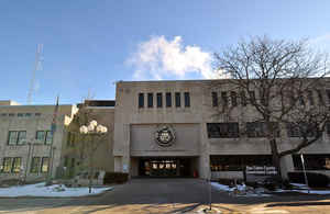
Eau Claire County is a county located in the state of Wisconsin. Based on the 2010 census, the population was 98,736. Its county seat is Eau
Claire. The county took its name from the Eau Claire River.
Eau Claire County is included in the Eau Claire, WI Metropolitan Statistical Area as well as the Eau Claire-Menomonie WI Combined Statistical
Area.
Etymology - Origin of Eau Claire County Name
In 1855..., the area which was identical in area with the present Eau Claire county, was set off as the town of Clear Water. On Oct. 6, 1856, the town of Eau Claire was set off as Eau Claire county by act of legislature.
[Source: p.30 of History of Eau Claire county by Bailey.]
Demographics:
County QuickFacts: CensusBureau Quick Facts
Eau Claire County History
Eau Claire County Wisconsin...was first known as the town of "Clearwater" and was the southern-most township in Chippewa County in 1855. It was during this same year that R. F. Wilson and W. H. Gleason came to the Clearwater settlement, at the junction of the Chippewa and Clearwater rivers. They recognized its possibilities and soon made a deal with Gage & Reed whereby a considerable part of what is now the east side was platted as the village of Eau Claire. Of course the platting of this village under the name Eau Claire could have no legal effect on the name of the town, but it seems to have confused the town officials, as the records show both the names Clearwater and Eau Claire for a short period, after which, without any recorded official action, the name Clearwater was dropped and the name Eau Claire only was used. The town remained under town government only one year, when by act of legislature approved October 6, 1856, it was set off as Eau Claire county.
Geography
As reported by the Census Bureau, the county has a total area of 645 square miles (1,670 km2), of which 638 square miles (1,650 km2) is
land and 7.3 square miles (19 km2) (1.1%) is water
Neighboring Counties
Bordering counties are as follows:
- Chippewa County - north
- Clark County - east
- Jackson County - southeast
- Trempealeau County - south
- Buffalo County - southwest
- Pepin County - west
- Dunn County - west
Education


Click Image to Enlarge
