


Click Image to Enlarge
Wisconsin Counties
There are seventy-two counties in the state of Wisconsin. Wisconsin became part of the Territory of Michigan and divided into two counties: Brown County in the northeast along Lake Michigan and Crawford County in the southwest along the Mississippi River. The state of Wisconsin was created from Wisconsin Territory on May 29, 1848, with 28 counties.Iron County, Wisconsin
Iron County Education, Geography, and History
Etymology - Origin of Iron County Name
Iron County was named for the amount of this ore to be found within its limits - Gannett, Place Names, p. 144.
[Source: Kellogg, Louise Phelps. "Derivation of County Names" in Proceedings of the State Historical Society of Wisconsin for 1909, pages 219-231.]
Demographics:
County QuickFacts: CensusBureau Quick Facts
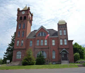
Iron County History
Iron was created on March 1, 1893 from Ashland County. The County Seat is Hurley.
In the late 1660's, with beaver hats the rage in Europe, Native Americans and French and English fur traders traveled
through Iron County on the Flambeau Trail, linking European markets to the much desired Northern Wisconsin commodity.
Native Americans traded locally-mined copper internationally via this wilderness "highway" trail.
The 1800's brought the lumbermen, and Iron County's white pine resources provided valuable lumber needed to build homes
in growing industrial cities. Railroad logging, development my timber barons like William Roddis, next moved hardwoods
to waiting mills. As the timber was exhausted, lumber companies converted their land holdings to capture more revenues.
Where there were lakes, resorts sprang up in the cutover, providing destinations for city vacationers. Immigrants, eager
to farm their own land, settled the cutover.
Iron County's iron mining history had a unique and profound impact. "Red Gold" drew immigrants here since the 1880's, to
mine the iron ore needed by a growing industrial America. Through the extraction of iron from the hills of Northern Iron
County's Penokee Range, Wisconsin made significant contributions to the fast moving industrial revolution of the world,
particularly in production of steel, building materials and automobiles. By the mid-1960's, iron mining ceased and Iron
County turned to tourism, successfully establishing itself as a major downhill skiing and snowmobiling destination in
Wisconsin and the Midwest. Today, Iron County's natural and historic resources make it an important four-season tourism
destination in Wisconsin. As a Wisconsin Heritage Area, it a "living" example of how the interaction of its people, with
its resources, influenced Wisconsin's place in the national and international community.
Geography: Land and Water
As reported by the Census Bureau, the county has a total area of 919 square miles (2,381 km2), of which, 757
square miles (1,961 km2) of it is land and 162 square miles (420 km2) of it (17.62%) is water.
Neighboring Counties
Bordering counties are as follows:
- Vilas County - east, southeast
- Price County - southwest
- Ashland County - west
- Gogebic County, Michigan - northeast
Education


Click Image to Enlarge
