


Click Image to Enlarge
Wisconsin Counties
There are seventy-two counties in the state of Wisconsin. Wisconsin became part of the Territory of Michigan and divided into two counties: Brown County in the northeast along Lake Michigan and Crawford County in the southwest along the Mississippi River. The state of Wisconsin was created from Wisconsin Territory on May 29, 1848, with 28 counties.Kewaunee County, Wisconsin
Kewaunee County Education, Geography, and History
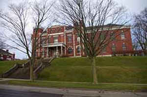
Kewaunee County is a county located in the state of Wisconsin. Based on the 2010 census, the population was 20,574. Its county seat is
Kewaunee. The county was created in 1852 and organized in 1859.
Kewaunee County is part of the Green Bay, WI Metropolitan Statistical Area as well as the Green Bay-Shawano, WI Combined Statistical Area.
Etymology - Origin of Kewaunee County Name
Kewaunee County - named for its chief river, which was early known as "Wood's River." In 1834 Joshua Hatheway, an early Wisconsin surveyor, rechristened it from the Chippewa word which he translated as "prairie hen" - Wis. Hist. Colls., i, p. 117. Verwyst, in Id. xii, p. 392, considers the word equivalent to a peninsula, almost surrounded by water, from the Chippewa term, "I cross a point of land by boat."
[Source: Kellogg, Louise Phelps. "Derivation of County Names" in Proceedings of the State Historical Society of Wisconsin for 1909, pages 219-231.]
Demographics:
County QuickFacts: CensusBureau Quick Facts
Kewaunee County History
Kewaunee County, created in 1852 from Manitowoc County, is named either for a Pottowatomi word meaning "river of
the lost," or a Chippewa word meaning "praire hen," "wild duck," or "to go around." Located in northeast Wisconsin,
the county seat is Kewaunee.
John W. Hunt's 1853 Wisconsin Gazetteer
"KEWAUNEE, County, is bounded on the north by Door county, on the east by the state line in Lake Michigan, on the south by Manitowoc, and on the west by Brown, and contains about thirteen townships of land. It was set off from Door, April 16, l852, and is attached to Manitowoc for judicial purposes. The streams are Kewaunee and Red rivers, Benton's, Martin's, Ashnepee and Thornapple creeks. The county having been so recently established, has not as yet reached to much dignity as a county."
KEWAUNEE.
From: Handbook of Wisconsin by S. Silas, 1855
pg. 78-79
A new and sparsely settled County, extending from Lake Michigan to Green Bay, and occupying the head of the peninsula. Its principal settlement is at the mouth of the Kewaunee, and its principal trade is lumber, which is cut on that stream. There is much Government land in Kewaunee and most of it of a very good quality.
Geography: Land and Water
As reported by the Census Bureau, the county has a total area of 1,085 square miles (2,809 km2), of which, 343 square miles (887 km2) of it is land and 742 square miles (1,921 km2) of it (68.41%) is water.
Neighboring Counties
Bordering counties are as follows:
- Door County - north
- Manitowoc County - south
- Brown County - west
Education


Click Image to Enlarge
