


Click Image to Enlarge
Wisconsin Counties
There are seventy-two counties in the state of Wisconsin. Wisconsin became part of the Territory of Michigan and divided into two counties: Brown County in the northeast along Lake Michigan and Crawford County in the southwest along the Mississippi River. The state of Wisconsin was created from Wisconsin Territory on May 29, 1848, with 28 counties.Richland County, Wisconsin
Richland County Education, Geography, and History
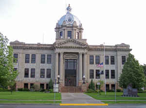
Richland County is a county in the state of Wisconsin. Based on the 2010 census, the population was 18,021. Its county seat is Richland Center. The county was created from the Wisconsin Territory in 1842 and organized in 1850. It is named for the high quality of its soil.
Etymology - Origin of Richland County Name
Richland is named for the rich farmland found within the county.
Demographics:
County QuickFacts: CensusBureau Quick Facts
Richland County History
Richland County, created in 1842 from Iowa County, is named for its rich farmland soil. Located in southwest
Wisconsin, the county seat is Richland Center.
John W. Hunt's 1853 Wisconsin Gazetteer
"RICHLAND, County, is bounded on the north by Bad Ax [Vernon] and Sauk, on the east by Sauk, on the south by Iowa, and on the west by Bad Ax and Crawford, and is about 24 miles square. It contains 16 townships in a square form, and some fractional ones on the Wisconsin river, which constitutes its southern boundary. It was set off from Iowa county 15th Feb. 1842 ... The seat of justice has been established at Richland Centre. There are 4 considerable mill streams running from north to south through the county, emptying into the Wisconsin - Bear Creek, in the east part - Pine River, running through the central - Eagle Creek, more westerly - and Knapp's Creek, in the extreme west. These streams, with their tributaries, supply the county abundantly. The water is invariably soft. There are some pretty prairies surrounded by groves of heavy timber. The face of the country is diversified by hills and valleys. Fishes - - pike, pickerel, codfish, mullet, suckers, and speckled trout, are in abundance. Plenty of the best timber such as maple, butternut, walnut, bass, ash, elm and oak of different kinds, with pine and poplar. Lead and copper have been discovered in the southern part. A marble quarry has been opened in the valley of the Bear Creek. All the stone is found in quarries - none scattered on the surface. There are many large tracts of well-watered and rich land in the county, hence the name. The county is settling rapidly with an intelligent and enterprizing population, almost wholly Americans. Its agricultural, mineral and lumbering resources, together with its proximity to an extensive mining country, and its facilities for market, serve as great inducements to settlement and cultivation. There are many thriving villages. Population in 1850 was 903, now about 3,000; with 76 farms, 175 dwellings, and 4 manufactories. "
[Source: Hunt, John W. Wisconsin Gazetteer (Madison, 1853)]
RICHLAND.
From: Handbook of Wisconsin by S. Silas, 1855
pg. 98-99
This is strictly an agricultural County, lying on the north side of the Wisconsin River. It is well watered and
well timbered, but not yet densely populated. The channels of immigration are up the Mississippi on the west, and up
the Wisconsin on the east, and Richland has failed to receive the attention it deserves. There is yet much good land
not occupied, and at no very distant day, it will command a good price. The face of the country is rolling,
sometimes rising into high bluffs. The County is mostly timbered, with maple, walnut, oak and pine, interspersed
with prairies. The water is soft, and abounds in fish. Lead and copper have been found in the southern part and
marble on Bear Creek.
The Milwaukee and Mississippi Rail Road passes along the southern boundary of the County, and will be the means of
developing its resources very rapidly, by facilitating the means of communication of travel and of immigration.
Richland, at the mouth of Pine River on the Wisconsin, is the principal village. Richland Centre contains a flouring
and grist mill, several stores, taverns &c., and is the County Seat.
Richland County is in the Mineral Point land district, except four towns in the north-west corner.
Geography: Land and Water
As reported by the Census Bureau, the county has a total area of 589 square miles (1,526 km2), of which, 586 square miles (1,518 km2) of it is land and 3 square miles (8 km2) of it (0.54%) is water.
Neighboring Counties
Bordering counties are as follows:
- Vernon County - north
- Sauk County - east
- Iowa County - southeast
- Grant County - southwest
- Crawford County - west
Education


Click Image to Enlarge
