


Click Image to Enlarge
Wisconsin Counties
There are seventy-two counties in the state of Wisconsin. Wisconsin became part of the Territory of Michigan and divided into two counties: Brown County in the northeast along Lake Michigan and Crawford County in the southwest along the Mississippi River. The state of Wisconsin was created from Wisconsin Territory on May 29, 1848, with 28 counties.Sheboygan County, Wisconsin
Sheboygan County Education, Geography, and History
Sheboygan County is a county in the state of Wisconsin. It is named after the Sheboygan River. Based on the 2010 census, the population was
115,507. Its county seat is Sheboygan. The county was created in 1836 and organized in 1846.
Sheboygan County comprises the Sheboygan, WI Metropolitan Statistical Area.
Etymology - Origin of Sheboygan County Name
Sheboygan County takes its name from a river emptying into Lake Michigan. Two meanings have been assigned to this word: "a noise underground," and "river disappearing underground" - Wis. Hist. Colls., i, p. 17, and Hist. No. Wis., p. 967; and "a perforated object, such as a pipe-stem, or hollow bone" - Wis. Hist. Colls., iii, p. 337; xii, p. 397.
[Source: Kellogg, Louise Phelps. "Derivation of County Names" in
Proceedings of the State Historical Society of Wisconsin for 1909, pages
219-231.]
Demographics:
County QuickFacts: CensusBureau Quick Facts
Sheboygan County History
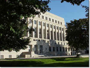
Sheboygan County was established on December 17, 1838
and is located in Eastern Wisconsin on the western shores of Lake Michigan.
Sheboygan County consists of 15 townships, 10 villages and 3 cities with a land
area of 513.7 square miles and a population of 112,640 as of 2000. The county is
surrounded by 5 other counties: Manitowoc County to the north, Calumet County to
the north west, Fond du Lac County to the west, Washington County to the south
west and Ozaukee County to the south.
Because government, at all levels, is so broad and provides so many
services, many citizens do not know what county government does or what services
it provides. The purpose of this web site is to give you an idea of what county
government is all about. Our goal is to foster interaction between the residents
of Sheboygan County and county officials.
John W. Hunt's 1853 Wisconsin Gazetteer
"SHEBOYGAN, County, is bounded on the north by Calumet and Manitowoc, on the east by the State line in Lake Michigan, on the south by Washington, and on the west by Fond du Lac. It was set off from Brown Dec. 7, 1836 The whole surface of the county is covered by a dense growth of timber, among which pine is found in considerable quantities along the margin of the principal streams. The seat of justice is at the village of Sheboygan, on the lake, centrally from the north and south boundaries of the county. It is watered by the Sheboygan river and its tributaries. Population in 1840 was 133; 1842, 227; 1846, 4637; 1847, 5,580; 1850, 8,836. There are 1,790 dwellings, 581 farms, and 30 manufactories."
SHEBOYGAN--Population 20,391.
From: Handbook of Wisconsin by S. Silas, 1855
pg. 101
Lies on Lake Michigan, 50 miles north of Milwaukee. It is heavily
timbered with oak, maple, ash, hickory and pine. The soil is light,
inclining in some parts to sand, but is productive, and raises wheat of the
best quality. Sheboygan wheat bears a higher price than that raised farther
south. The population is American, German and Dutch. The Nieusbode, the only
Dutch paper, with but one exception, published in the United States, is
printed here. A plank road extends from Sheboygan to Fond du Lac. There is
but little public land in market. It is in the Menasha land district, expect
the southern tier of towns, which is in the Milwaukee.
Sheboygan, the principal place, is on the Lake Shore, and is the principal
port of shipment for a large back country. For its exports and imports see
the appropriate article.
Geography: Land and Water
As reported by the Census Bureau, the county has a total area of 1,271 square miles (3,292 km2), of which, 514 square miles (1,330 km2) of it is land and 757 square miles (1,962 km2) of it (59.59%) is water.
Neighboring Counties
Bordering counties are as follows:
- Manitowoc County - north
- Ozaukee County - south
Washington County - southwest - Fond du Lac County - west
- Calumet County - northwest
Education


Click Image to Enlarge
